Home
Search for Books
How to order
Your orders
Customer Comments
Join our mailing list
About
Bookbinding
Search for Books
How to order
Your orders
Customer Comments
Join our mailing list
About
Bookbinding

IBAN:
GB74 BUKB 2017 9210 0341 93
SWIFTBIC:BUKBGB22
GB74 BUKB 2017 9210 0341 93
SWIFTBIC:BUKBGB22
'Wrapro' card boxes which we use for packaging are produced and made from 100% recyclable material
The protective bubble wrap bags we use for packaging are made from 100% Oxo-Biodegradable starch
Little Stour Books was established in 1996
by Colin Button.
© Little Stour Books 2022
KENT [Dover]
Showing author names starting with -
The Life and Times of a Dovorian; Lillian Kay
Leach, Derek [Compiled and Researched by](Book #ID 79182)
Published by the Author, Dover First Edition 1999. Dover 1999.
First edition in publisher's original colour illustrated card wrap covers [softback]. 8vo. 9½'' x 6½''. Contains 105 printed pages of text with monochrome photographs throughout. Light rubs to all cover edges and corners, minimal dust marking to the closed page edges and in near Fine clean unopened condition, no dust wrapper as published. Member of the P.B.F.A. ISBN 0953616606
Click here to select books from the
KENT [Dover] Category
£9.00
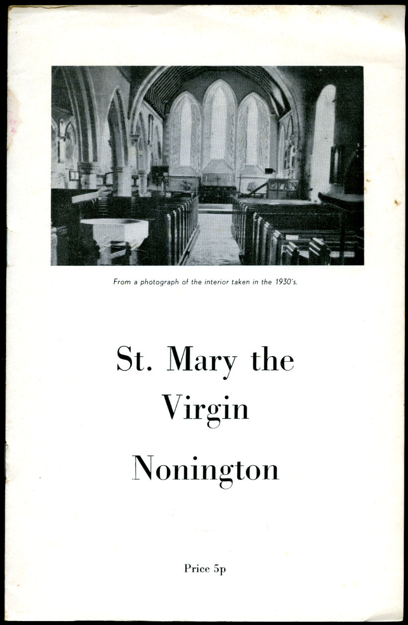
St. Mary the Virgin Nonington (Variously, Nonnington, Nunyngton, Nonnyngton and Nunnington)
(Book #ID 96824)
Printed by Kent County Printers, Canterbury and Herne Bay circa 1960. 1960.
Publisher's original stapled white card wrap covers [soft back] with photograph of the interior taken in the 1930's to the front cover. 8vo. 8½'' x 6''. Contains 8 (including the covers) printed pages of text. Small stain to the rear cover and in Very Good condition, no dust wrapper as issued. Member of the P.B.F.A.
Click here to select books from the
KENT [Dover] Category
£11.00
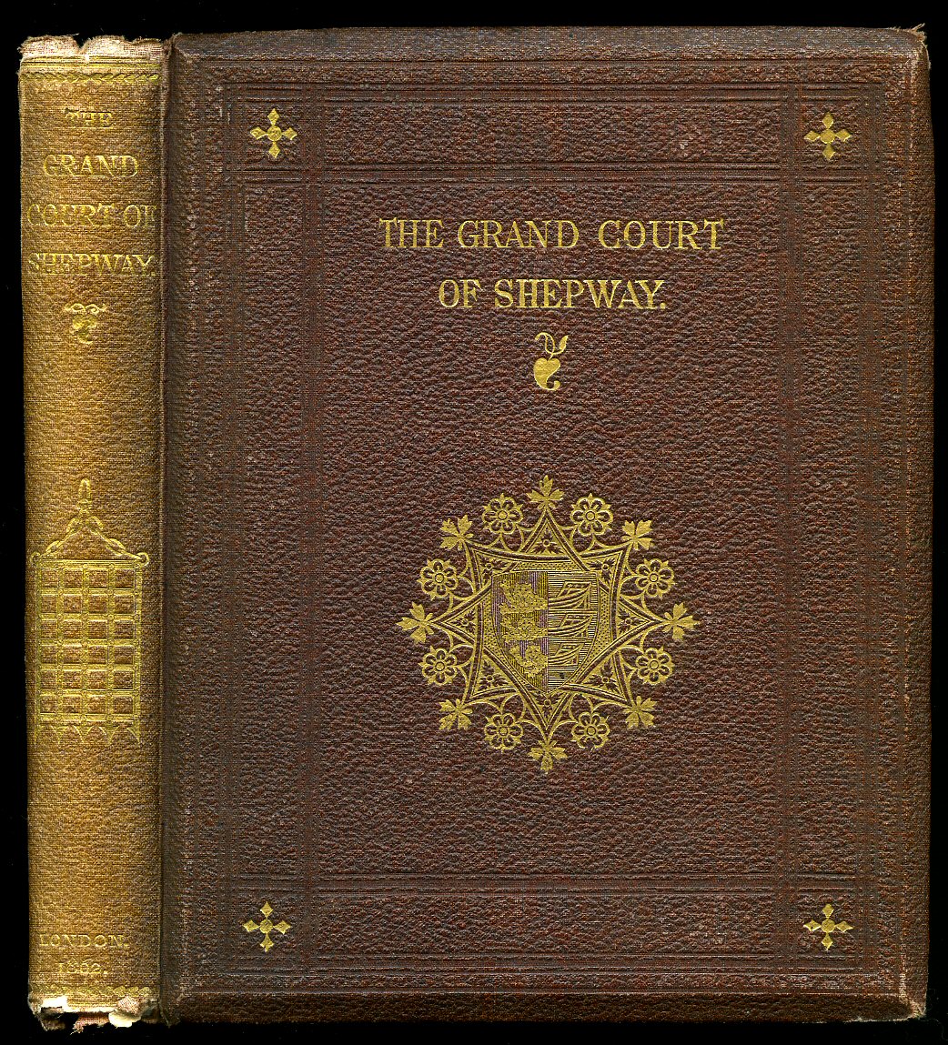
An Account of the Grand Court of Shepway, Holden on the Bredenstone Hill, at Dover, for the Installation of The Right Honourable Henry John Temple, Viscount Palmerston, First Lord of the Treasury, as Constable of HM Castle of Dover, and Warden and Keeper of HM Cinque Ports, etc. August 28, 1861.
Knocker, Edward [Seneschal of the Court, Registrar of the Cinque Ports, and Town Clerk of Dover](Book #ID 12028)
Published by John Russell Smith 36 Soho Square, London First edition 1862. 1862.
First edition hard back publisher's original deep maroon cloth covers, gilt stamping and vignettes to spine and upper panel, top edge gilt, fore and lower edges untrimmed, bevelled edges. 8vo 8¾" x 7" xx, 164 [pp]. Two illustrations, chapter headers. New end papers, some underlining with soft red pencil, sporadic light foxing, fraying of cloth to spine tips and corners. Acetate protected. Member of the P.B.F.A.
Click here to select books from the
KENT [Dover] Category
£195.00
Proposed Plan for Improving Dover Harbour, by an Extension of the South Pier Head, etc. Also, Copious Extracts from Various Authors in Support of the Plan, and Shewing the Importance of Dover Harbour from the Time of the First Construction. Together with Practical Observations and Illustrations [Signed]
Worthington, Lieut. B[enjamin] R.N.(Book #ID 13416)
Printed by W. Batcheller, King's Arms Library, Dover First Edition 1838. 1838.
First edition contemporary tooled dark green calf, gilt title and border to upper panel, gilt cross bands to spine, diamond gilt motif and border to lower panel, marble end papers. 10¼" x 6¼" 174pp. SIGNED by the author to additional leaf. Seven plates as called for with the exception of plates [ii and vii] are fold-out and linen backed : [i] Frontispiece Plan of Dover in the reign of Elizabeth. [ii] West view of breakwater and apron, shewing the position of the culverts. [iii] East view of breakwater, piers, and sea wall at high water. [iv] Dover harbour shewing the improvements. [v] Plan of Dover harbour and Castle jetty. [vi] Elevation of store houses in the sea wall next to the proposed addition to basin and elevation of sea wall and platform battery. [vii] Plan of Landing Stairs and parapet wall. Seven additional tipped-in plates preceding frontispiece are all fold-out and linen backed. [i] Print of one of the earliest Plans of Dover. It represents the Town, Castle, and Harbour, in the time of King Henry the Eighth, when the sea washed the cliff behind Sandgate Street. The Spire of St. John's Church, [demolished in 1537,] is distinctly visible behind the Hills on the Canterbury Road, and the remains of a Spire are also apparent on the Maison Dieu. The building on the heights to the left of the Roman Pharos, nearly in a line with Archcliff Chapel, was in olden time the house of the Knights Templars. The original Drawing, which is unique, is preserved amongst the Cotton Manuscripts in the British Museum: It is upwards of six feet long, and forms one of the greatest topographical rarities connected with the early History of the County of Kent. [ii] A Plan of Dover in the Reign of Queen Elizabeth. [iii] 21" x 16" Rob Havell & Son engraving of the 'View of Dover from the South Pier Head.' [iv] 10" x 15½" Drawn from nature and on stone by T. S. Cooper 'View of Dover Pier and Castle Cliffs, from the Stone Head.' [v] 10" x 14½" Drawn by E. Stock on stone by A. Picken 'View of Dover Harbour , Western Heights, Shakespeare's Cliff, etc. from the sea.' [vi] 'Dover Pier and Harbour from the Heights.' [vii] 5½" x 4' 10" six section folding panorama with tiny text below detailing: Folkestone, Shakespeare's Cliff, Archcliff Fort, Stone Head, Military Hospital, Harbour Entrance, Amherst Battery, Barracks, Redoubt, Esplanade, Theatre, Waterloo Crescent, Baths, Marine Parade, Guildford Battery, Prospect Place, East Cliff Place and Jetty, Signal Station, and South Foreland. Some foxing and staining to plates, general rubbing and soiling to exterior, 25 mm cracking to spine tip, hinges starting. Member of the P.B.F.A.
Click here to select books from the
KENT [Dover] Category
£1200.00
Stories of Dover and The Grand Tour [Volume IV of 'Stories' Series] [Signed]
Smith, Leslie [C. Leslie W. Smith](Book #ID 85550)
Published by the Author, Faversham, Kent First Edition 1981. 1981.
First edition hard back binding in publisher's original colour photographic matt paper covered boards. 8vo. 8½'' x 5½''. Contains 272 printed pages of text with colour and monochrome illustrations and photographs throughout. In Fine condition, no dust wrapper as issued. SIGNED by the Author to the copyright page 'To Alf, with best wishes, Leslie Smith.' Member of the P.B.F.A.
Click here to select books from the
KENT [Dover] Category
£65.00
Down the Line to Dover: A Pictorial History of Kent's Boat Train Line
Searle, Muriel V.(Book #ID 15792)
Midas Books, Tunbridge Wells, Kent 1984. 1984.
Hard back binding in publisher's original green paper covers, gilt lettering to spine. 8vo 10'' x 7½'' 163 printed pages of text. ISBN 085936206X. Monochrome photographic illustrations on matt paper. Without any ownership markings. Fine condition book in Fine condition price clipped dust wrapper. Dust wrapper supplied in archival acetate film protection. Member of the P.B.F.A.
Click here to select books from the
KENT [Dover] Category
£9.50
The Book of Dover: Cinque Port, Port of the Passage, Gateway to England [Signed]
Green, Ivan(Book #ID 17232)
Published by Barracuda Books Limited, Chesham, Buckingham, First Edition 1978. 1978.
First edition hard back binding in publisher's original grey cloth covers, gilt lettering to spine and upper panel. Quarto Royal 12" x 8½" 144 pp. ISBN 0860230600. Illustrated blue tinted end papers, archive monochrome photographic illustrations. SIGNED by the author No. 366 of 500 Limited Edition copies. List of Subscribers to rear. Small white fleck marks to boards, without inscription. Very Good in Fine dust wrapper, not price clipped. Dust wrapper supplied in archival acetate film protection. Member of the P.B.F.A.
Click here to select books from the
KENT [Dover] Category
£55.00
The Church and Fortress of Dover Castle [2]
Puckle, Rev. John [Illustrated by J. R. Jobbins](Book #ID 19825)
John Henry and James Parker Oxford and London 1864. 1864.
Hard back publisher's original maroon cloth covers, oxidised gilt lettering to spine, brown paper end papers. 8vo 9" x 6" 132, 8 [pp] catalogue. Two aquatint cold plates by J. R. Jobbins, two fold-out plans, seven monochrome illustrations. 10 mm snagging of cloth to spine tip, spine slightly faded, corners soft and turned-in and in Very Good clean condition. Member of the P.B.F.A.
Click here to select books from the
KENT [Dover] Category
£25.00
Ordnance Survey Map Provisional Edition: Sheet 61/24 Lydden
(Book #ID 20814)
Published by Ordnance Survey Office Chessington, Surrey 1947. 1947.
Colour fold-out paper map in 'Proof Copy' plain brown card wraps, white paper titles adhered to card front, tape to edges. Scale 1 : 25,000 or about 2½ inches to 1 mile. Member of the P.B.F.A.
Click here to select books from the
KENT [Dover] Category
£11.00
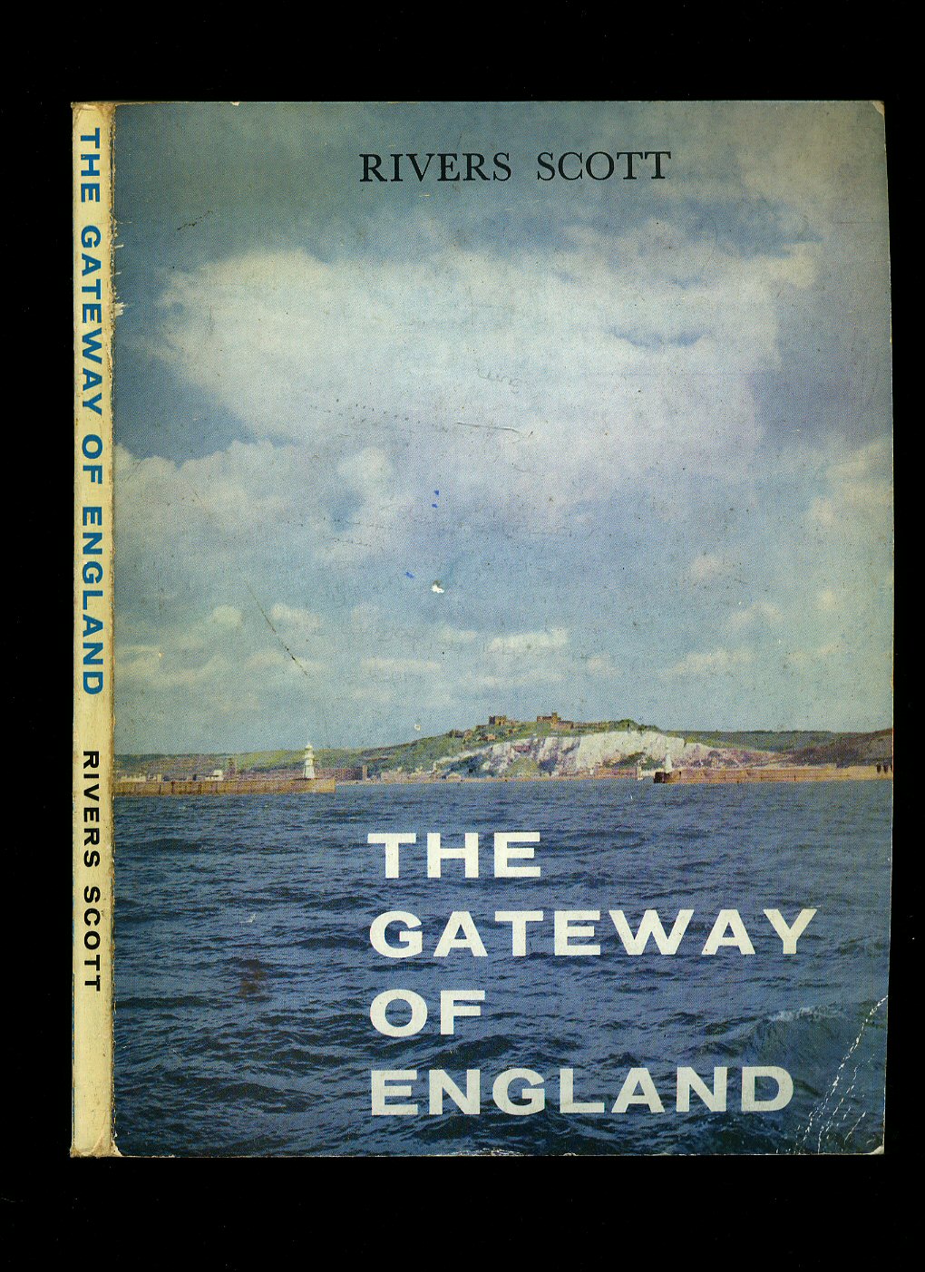
The Gateway of England; Dover, Past and Present Celebrating its 350th Anniversary
Scott, Rivers [Congratulatory Letter by Winston Spencer Churchill](Book #ID 57132)
Published by The Dover Harbour Board, First Edition 1956. Dover 1956.
Publisher's original monochrome illustrated card wrap covers. Quarto 10'' x 7½''. Contains 48 printed pages of text followed by 48 pages of monochrome photographs. Upper corners just curled up, without any ownership markings and in Very Good condition, no dust wrapper as published. Member of the P.B.F.A.
Click here to select books from the
KENT [Dover] Category
£15.00
British Association Geological Excursion, West Cliff, Dover
McDakin, Captain and Dr. Arthur Rowe [British Association Dover](Book #ID 76589)
Printed Privately by the Author S. Gordon McDakin, Dover Natural History Society 1877. 1877.
Publisher's original stapled sand paper covers, black title lettering to the front cover. 8vo. 6½'' x 4''. Contains 8 printed pages of text with monochrome diagram. In Very Good clean condition. Member of the P.B.F.A.
Click here to select books from the
KENT [Dover] Category
£35.00
John Philipot's Roll of the Constables of Dover Castle and Lord Wardens of the Cinque Ports 1627
Steer, Francis W. [Introduction and Notes by] Foreword by Sir Winston Churchill(Book #ID 56470)
Published by G. Bell and Sons, Ltd., York House, Portugal Street, London First Edition 1956. London 1956.
First edition hard back binding in publisher's original royal blue cloth covers, gilt title to the spine and the upper panel. Quarto. 10'' x 8''. Contains 31 printed pages of text with monochrome frontispiece of The Duke of Buckingham with eight pages of colour illustrations of the heraldic shields of the Constables of Dover Castle. Ghosting to the end papers. Very Good condition book, in near Fine condition dust wrapper with just a little darkening to the spine, price clipped. Dust wrapper supplied in archive acetate film protection, this protects and prolongs the life of the paper, it is not adhered to the book or to the dust wrapper. Member of the P.B.F.A.
Click here to select books from the
KENT [Dover] Category
£25.00
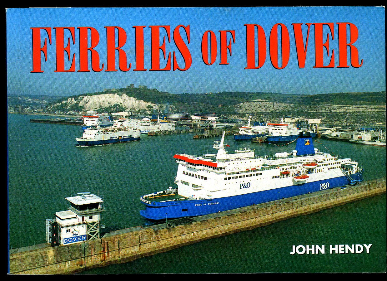
Ferries of Dover
Hendy, John(Book #ID 49465)
Published by Ferry Publications, 25 Corner Farm Road, Staplehurst, Kent 1993. 1993.
Publisher's original colour photographic card wrap covers. 8vo. 7½'' x 5¼''. ISBN 0951350692. Contains 80 printed pages of text with monochrome photographs throughout. Without any ownership markings and in Fine condition, no dust wrapper as published. Member of the P.B.F.A.
Click here to select books from the
KENT [Dover] Category
£11.00
Ferries of the English Channel Past and Present
Cowsill, Miles and John Hendy(Book #ID 49462)
Published by Ferry Publications, 25 Corner Farm Road, Staplehurst, Kent 1992. 1992.
Publisher's original colour photographic card wrap covers. 8vo. 8½'' x 6''. ISBN 0871947138. Contains 56 printed pages of text with monochrome photographs throughout. Without any ownership markings and in Fine condition, no dust wrapper as published. Member of the P.B.F.A.
Click here to select books from the
KENT [Dover] Category
£6.00
Barfreystone Church (Alternative Spellings are Barfreston and Barfrestone].
Hessing, O.B.E., M.B.E., Edward(Book #ID 96832)
Published and Printed for the Author by by Kentish Gazette Printing Service, 9 St. George's Place, Canterbury, Kent circa 1960. 1960.
Publisher's original plain white card wrap covers [soft back]. 8vo. 8½'' x 5¼''. Barfreystone is a village in East Kent, between Shepherdswell, Eythorne and Nonington, and close to the pit villages of Elvington and Snowdown, it is on the Miner's Way Trail which links the coalfield parishes of East Kent. Contains 35 (+ covers) single-sided printed pages of text with 11 full-page monochrome photographs throughout. Slight grubbiness to the white card covers and in Very Good condition, no dust wrapper as issued. Member of the P.B.F.A.
Click here to select books from the
KENT [Dover] Category
£25.00
Reflections of River; The Kentish Village
Welby, Douglas(Book #ID 89572)
Published by the Author, 2 The Ridgeway, River, Dover First Edition 1997. 1997.
First edition hard back binding in publisher's original colour illustrated paper covered boards. Quarto 10'' x 8''. Contains 209 printed pages of text with colour and monochrome illustrations and photographs throughout. In Fine condition, no dust wrapper as issued. Member of the P.B.F.A. ISBN 0906124174
Click here to select books from the
KENT [Dover] Category
£17.50
Dover in Old Picture Postcards | Volume 1 (One | I)
Hollingsbee, Bob(Book #ID 114763)
Published by European Library Publishers, The Netherlands Second Edition 1993. 1993.
Second edition hard back binding in publisher's original aqua blue paper covered boards, black title lettering to spine and the front cover. Oblong 8vo. 6'' x 8¼''. Contains seventy-five archive monochrome photographic illustrations on semi-glossy paper with detailed text below. In Fine condition, no dust wrapper as issued. Member of the P.B.F.A.
Click here to select books from the
KENT [Dover] Category
£11.00
Dover | A Pictorial History
Green, Ivan(Book #ID 114726)
Published by Phillimore & Co. Ltd., Shopwyke Hall, Chichester, Sussex First Edition 1987. 1987.
First edition hard back binding in publisher's original royal blue paper covered boards, gilt title and author lettering to the spine. Quarto 10'' x 7½''. Contains unpaginated printed pages of text with 163 monochrome illustrations and photographs throughout. Fine condition book in Fine condition price clipped dust wrapper. Dust wrapper supplied in archive acetate film protection, it does not adhere to the book or to the dust wrapper. Member of the P.B.F.A.
Click here to select books from the
KENT [Dover] Category
£8.00
The Roman Painted House at Dover
Philp, Brian(Book #ID 39952)
Published by Kent Archaeological Rescue Unit Dover Castle, Kent First Edition circa 1989. 1989.
Publisher's original stapled illustrated card covers. 8vo 8½'' x 5¼'' 16 pp. Colour and monochrome illustrations throughout. In Fine condition, no dust wrapper as published. Member of the P.B.F.A.
Click here to select books from the
KENT [Dover] Category
£5.00
East Kent Colliery, Eythorne, Kent Monochrome Postcard
(Book #ID 40604)
circa 1920. 1920.
5½'' x 3½'' unused monochrome post card. In Good condition with sun fading. Member of the P.B.F.A.
Click here to select books from the
KENT [Dover] Category
£11.00
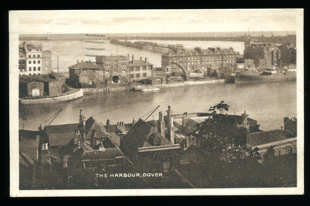
The Harbour, Dover, Kent Monochrome Postcard
(Book #ID 40608)
Post Office Dated 1923. 1923.
5½'' x 3½'' used monochrome post card. Post Office mark and date, stamp, address and personal message to the reverse. In Very Good condition. Member of the P.B.F.A.
Click here to select books from the
KENT [Dover] Category
£11.00
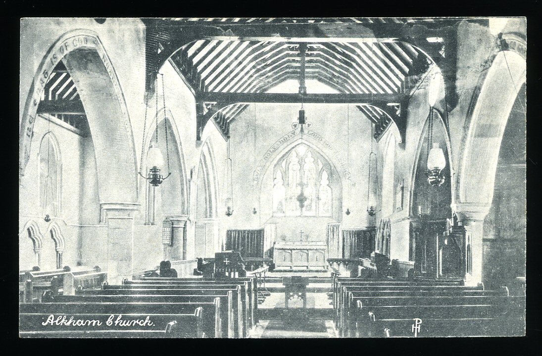
Alkham Church, Kent Monochrome Postcard
(Book #ID 40610)
circa 1925. 1925.
5½'' x 3½'' unused monochrome post card. In Very Good condition. Member of the P.B.F.A.
Click here to select books from the
KENT [Dover] Category
£6.00
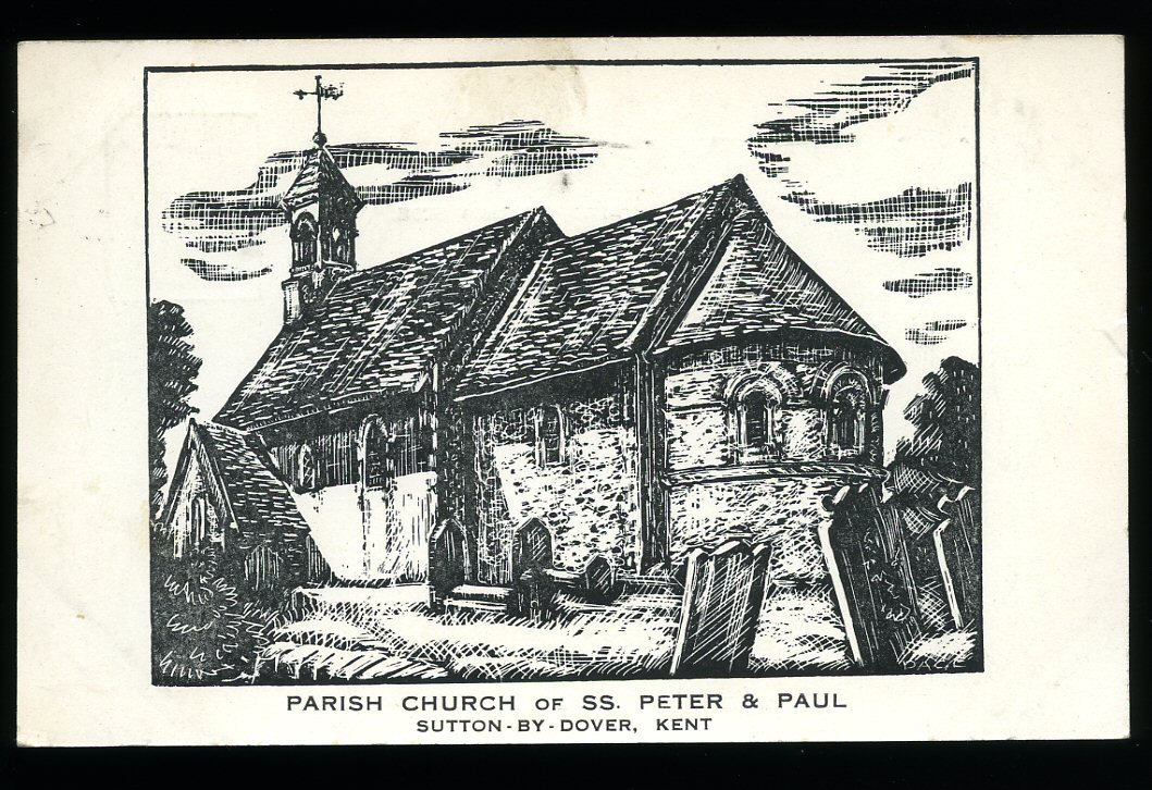
Parish of Church of SS. Peter and Paul, Sutton by Dover, Kent Monochrome Postcard
(Book #ID 40615)
Post Office Dated 1952. 1952.
5½'' x 3½'' used monochrome post card. Post Office mark and date, stamp, address and personal message to the reverse. In Very Good condition. Member of the P.B.F.A.
Click here to select books from the
KENT [Dover] Category
£6.00
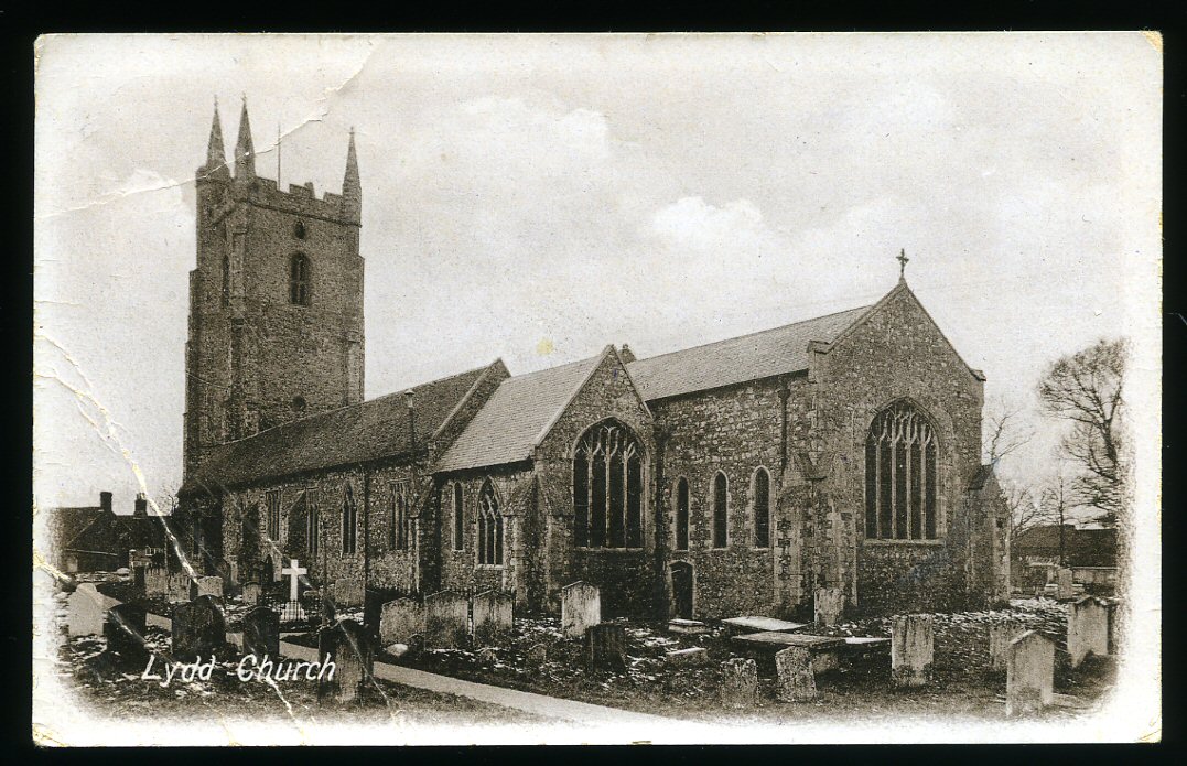
Lydd Church, Kent Monochrome Postcard
(Book #ID 40630)
Post Office Dated 1924. 1924.
5½'' x 3½'' used monochrome post card. Post Office mark and date, stamp, address and personal message to the reverse. Thin crease lines across the lower left corner and in Very Good condition. Member of the P.B.F.A.
Click here to select books from the
KENT [Dover] Category
£6.00
The Abbey, Kearsney, Kent Colour Postcard
(Book #ID 40644)
Post Office Dated 1926. 1926.
5½'' x 3½'' used colour post card. Post Office mark and date, stamp, address and personal message to the reverse. In Very Good condition. Member of the P.B.F.A.
Click here to select books from the
KENT [Dover] Category
£6.00
Shakespeare Cliff, Dover, Kent Colour Postcard
(Book #ID 40648)
Post Office Dated 1920. 1920.
5½'' x 3½'' used colour post card. Post Office mark and date, stamp, address and personal message to the reverse. In Very Good condition. Member of the P.B.F.A.
Click here to select books from the
KENT [Dover] Category
£7.00
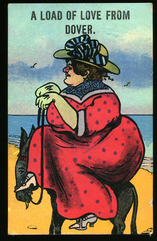
Comic Colour Postcard 'A Load of Love From Dover' [Kent]
(Book #ID 40650)
Post Office Dated 1914. 1914.
5½'' x 3½'' used colour post card. Post Office mark and date, stamp, address and personal message to the reverse. Fat lady sitting on a beach donkey. In Very Good condition. Member of the P.B.F.A.
Click here to select books from the
KENT [Dover] Category
£12.50
Dover Harbour (Harbor) Board 1646 [The Port of Dover]
Jones, Oliver G. B. [Edited by] of The Dover Express (Dover Harbour Board, Sir Joseph Causton & Sons)(Book #ID 89230)
Printed by Sir Joseph Causton & Sons Ltd., Faversham and London circa 1932. 1932.
Probably first edition hard back binding in publisher's original slate blue and navy blue paper covered boards, Cinque ports coat of arms in gilt to the front cover. Landscape 8'' x 10''. Contains 64 pages with four maps and monochrome photographs of Dover docks as they were in the 1920's showing: 'T. S. S. Cote d'Azur', turbine twin-screw steamer 'Canterbury', dock constructions, horse drawn wagons, vintage car ferries, Ropeway from Tilmanstone Colliery to the docks, cranes and platforms for loading vehicles, Southern Railway Motor Car Ferry Service. In Fine condition, no dust wrapper as issued. Member of the P.B.F.A.
Click here to select books from the
KENT [Dover] Category
£125.00
Dover's Catholic Faith; A Book to Celebrate and Honour the Restoration of St. Paul's Church, Dover
Mackenzie, Robert A.(Book #ID 70633)
Published by the Roman Catholic Parish of St. Paul the Apostle, Dover First Edition 1988. Dover 1988.
First edition in publisher's original illustrated card wrap covers [softback]. 8vo. 8½'' x 6''. Contains 181 printed pages of text with colour and monochrome photographs to the centre. In near Fine condition, no dust wrapper as published. Member of the P.B.F.A.
Click here to select books from the
KENT [Dover] Category
£15.00
Down the Line to Dover: A Pictorial History of Kent's Boat Train Line
Searle, Muriel V.(Book #ID 45128)
Published by Bloomsbury Books Ltd., London 1988. London 1988.
Hard back binding in publisher's original green paper covers, gilt lettering to the spine, end paper maps. 8vo 10'' x 7½'' 163 printed pages of text. ISBN 1870630416. Monochrome photographic illustrations on matt paper. Without any ownership markings. Fine condition book in Fine condition price clipped dust wrapper. Dust wrapper supplied in archival acetate film protection. Member of the P.B.F.A.
Click here to select books from the
KENT [Dover] Category
£9.50
Dover Corporation; An Account of the Corporation Insignia, Seals and Plate, with Lists of Mayors, Borough Officers and Honorary Freemen, and Particulars of the Portraits and Principal Pictures, the Property of the Corporation; of the Stained Glass Windows in the Town Hall; and the Corporation Charities [Signed]
Knocker, E. Wollaston [Town Clerk and Honorary Librarian](Book #ID 47341)
Printed by A. Ezra, Priory Place and Military Road, Dover 1898. Dover 1898.
Hard back binding in publisher's original dark green cloth covers, gilt title lettering to the upper panel, lemon end papers. 8vo. 10'' x 6''. Contains 58 printed pages of text with two full-page plates and a couple of small monochrome illustrations throughout. Age tanning to the free fly papers, minor rubbing to the corners and spine tips and in Very Good clean and sound condition. SIGNED dedication copy by the author to the title page 'Richard Turner Esq. from the compiler E. Wollaston Knocker.' Member of the P.B.F.A.
Click here to select books from the
KENT [Dover] Category
£350.00
Down the Line to Dover: A Pictorial History of Kent's Boat Train Line
Searle, Muriel V.(Book #ID 48473)
Published by Bloomsbury Books Ltd., London 1988. London 1988.
Hard back binding in publisher's original green paper covers, gilt lettering to the spine, end paper maps. 8vo 10'' x 7½'' 163 printed pages of text. ISBN 1870630416. Monochrome photographic illustrations on matt paper. Without any ownership markings. Near Fine condition book in Very Good condition dust wrapper with a small crinkle of the paper to the top front cover, not price clipped. Dust wrapper supplied in archival acetate film protection. Member of the P.B.F.A.
Click here to select books from the
KENT [Dover] Category
£8.00
A Saunter Through Kent With Pen and Pencil Volume IV [4] Tenterden, St. Michaels, Small Hythe, Little Chart, Betteshanger, Northbourne, Brenchley and Matfield.
Igglesden, Charles [Sir Charles Igglesden born 1861 - died June 26th 1949, buried in Ashford Cemetery. Grandson of William Igglesden, founder of The Kentish Express who lived at Northbrook, Canterbury Road, Ashford. The Igglesden family diversified into Estate Agency, Land Agents, Removals, and Funeral Directors, however the Igglesden name disappeared from the High Streets of East Kent during the third quarter of the twentieth century, another casualty of 1970's economic slump?] Illustrated by Xavier Willis(Book #ID 48762)
Published at the Offices of the Kentish Express, Ashford, Kent First Edition 1902. 1902.
First edition hard back binding in publisher's original powder blue cloth covers, white title and author lettering to the upper panel. Quarto. 10'' x 7½''. Contains 90 [ii] printed pages of text with tissue guarded monochrome illustrations throughout. Thin surface damp stain line to the front fore edge, contents not affected, a little brown ghosting to the end papers, without any ownership markings and in Very Good condition. We currently hold in stock 32 other titles by this author from this series. Member of the P.B.F.A.
Click here to select books from the
KENT [Dover] Category
£95.00
A Saunter Through Kent With Pen and Pencil Volume XXI [21] Challock, Molash, Badlesmere, Leaveland, Throwley, Newchurch, Ivychurch, Adisham, Whitfield.
Igglesden, Charles [Sir Charles Igglesden born 1861 - died June 26th 1949, buried in Ashford Cemetery. Grandson of William Igglesden, founder of The Kentish Express who lived at Northbrook, Canterbury Road, Ashford. The Igglesden family diversified into Estate Agency, Land Agents, Removals, and Funeral Directors, however the Igglesden name disappeared from the High Streets of East Kent during the third quarter of the twentieth century, another casualty of 1970's economic slump?] Illustrated by Xavier Willis(Book #ID 48779)
Published at the Offices of the Kentish Express, Ashford, Kent First Edition 1927. Ashford 1927.
First edition hard back binding in publisher's original powder blue cloth covers, white title and author lettering to the spine and the upper panel. Quarto. 10'' x 7½''. Contains 81 [ii] printed pages of text with tissue guarded monochrome illustrations throughout. A little brown ghosting to the end papers, without any ownership markings, corners sharp and pointed and in Very Good clean and bright condition. Lists up to volume XXI. We currently hold in stock 32 other titles by this author from this series. Member of the P.B.F.A.
Click here to select books from the
KENT [Dover] Category
£95.00
Browse our
Book Categories
AEROPLANES (230)
AFGHANISTAN (15)
AFRICA [Ethiopia] (22)
AFRICA [Ghana] (15)
AFRICA [Kenya] (19)
AFRICA [Malawi] (3)
AFRICA [Mali] (6)
AFRICA [Mozambique] (4)
AFRICA [Nigeria] (14)
AFRICA [Tanzania] (11)
AFRICA [Uganda] (13)
AFRICA [Zambia] (8)
AFRICAN CONTINENT (74)
AGRICULTURE & FARMING (171)
ALBANIA (6)
AMERICA [Civil War] (40)
AMERICA [History] (298)
AMERICA [Indian History] (73)
AMERICA [Literature] (184)
AMERICA [World War II] (23)
ANDERSEN, Hans Christian (18)
ANGLING & SPORT FISHING (130)
ANIMAL SCIENCES (20)
ANNUALS & YEARBOOKS (144)
AQUARIUM & TROPICAL FISH (10)
ARBORICULTURE (39)
ARCHAEOLOGY (421)
ARCHAEOLOGY (Industrial) (32)
ARCHAEOLOGY (Roman Britain) (115)
ARCHAEOLOGY (Scotland) (161)
ARCHITECTURE (391)
ARGENTINA (9)
ART & CRAFT [Japanese] (42)
ART [American] (76)
ART [Applied] (25)
ART [Australian] (15)
ART [Austrian] (9)
ART [British] (324)
ART [Chinese] (34)
ART [Flemish and Dutch] (72)
ART [French] (131)
ART [German] (60)
ART [Indian] (8)
ART [Italian] (69)
ART [Nouveau and Deco] (29)
ART [Russian] (23)
ART [Spanish] (39)
ART [Surrealism] (44)
ART [Technique & Materials] (137)
ARTILLERY, ARMS & ARMOUR (32)
ASIAN CONTINENT (48)
ASTÉRIX French Comic Series (20)
ASTRONAUTICS (18)
ASTRONOMY & COSMOLOGY (63)
AUSTEN, Jane (1775-1817) (25)
AUSTRALIA (Terra Australis) (87)
AUSTRIA (25)
AVIATION & AERONAUTICS (229)
AZERBAIJAN (6)
BALKANS (15)
BALLET & BALLERINAS (30)
BATES, H. E. (1906-1974) (226)
BATTLE OF BRITAIN (110)
BEDFORDSHIRE (14)
BEEKEEPING & APIARISTS (39)
BELGIUM (Gallia Belgica) (26)
BERKSHIRE (Bearroc) (30)
BICYCLES & CYCLING (10)
BIO (Résumé, Memoir) (1019)
BIOLOGY (65)
BLACKSMITHING (7)
BLYTON, Enid (1897-1968) (93)
BOLIVIA (3)
BOOKMARKS (219)
BOOKS (Binding, Collecting, Printing, Paper) (157)
BOTANY (Phytology) (114)
BOY SCOUTS & GIRL GUIDES (45)
BOY'S OWN PAPER (167)
BRAZIL (Brasil) (20)
BRENT-DYER, Elinor M. (14)
BRIDGE, CHESS & GAMES (86)
BRIDGES & TUNNELS (30)
BRITAIN IN PICTURES (174)
BRITISH IMPERIAL EMPIRE (40)
BRITISH PREHISTORY (81)
BROADSHEETS (241)
BRONTË SISTERS (19)
BUCKINGHAMSHIRE (30)
BUDDHISM, HINDU, DHARMA (29)
BUILDING CONSTRUCTION (65)
BURMA, BURMESE (Myanmar) (115)
BUSES & COACHES (142)
BUSINESS (Leadership) (81)
CAGE & AVIARY BIRDS (29)
CAMBRIDGESHIRE (31)
CAMPAIGN MEDALS (15)
CAMPANOLOGY (1)
CANADA (History & Culture) (113)
CANAL BARGES & WATERWAYS (56)
CANARY ISLANDS (4)
CARAVANS & DORMOBILES (14)
CARPENTRY & D.I.Y. (57)
CARPETS & ORIENTAL RUGS (16)
CARROLL, Lewis (1832-1898) (12)
CARTOGRAPHY, MAPS, PLANS (145)
CATS [Pedigree Domestic Pets] (117)
CENTRAL AMERICA (31)
CERAMICS & POTTERY (249)
CHANNEL ISLANDS (25)
CHEMISTRY (42)
CHESHIRE (Palatine of Chester) (17)
CHILDREN'S & JUVENILE (2168)
CHILE (11)
CHINA & CHINESE HISTORY (104)
CHIVALRY & KNIGHTHOOD (22)
CHRISTIE, Agatha (1890-1976) (23)
CHURCHILL, Winston L. S. (65)
CIGARETTE & TEA CARDS (64)
CINEMA [Front of House Press Photograph] (108)
CINEMA, SCREEN & FILMS (271)
CIRCUS & FAIRGROUNDS (27)
CLIMATOLOGY & WEATHER (16)
COLOMBIA (11)
COMMERCIAL VEHICLES (39)
COMMUNISM (26)
CONCORDE (British Airways) (30)
COOK, Captain James (6)
CORNWALL (Kernow) (103)
COUNTY DURHAM (31)
CRETE (Kriti / Krete) (9)
CRIMEA and GEORGIA (23)
CROSBY, Bing (1903-1977) (197)
CUBA (Republic of Cuba) (13)
CYPRUS (Republic of Cyprus) (11)
CZECHOSLOVAKIA (62)
DANCING & CHOREOGRAPHY (27)
DECORATIVE ARTS (194)
DEFOE, Daniel (c. 1660-1731) (18)
DEMOGRAPHY (Populations) (39)
DENMARK (Danish Danmark) (20)
DENMARK (Danish | Danmark) (7)
DERBYSHIRE (Peak District) (19)
DETECTIVE | CRIME FICTION (769)
DEVONSHIRE (Dumnonia) (144)
DICKENS, Charles (1812-1870) (53)
DITCHFIELD SERIES (412)
DIVING & SNORKELLING (12)
DOGS (Pedigree Pets) (90)
DOLLS’ HOUSES & DOLLS (43)
DORSET (Durnovaria) (66)
DOYLE, [Sir] Arthur Conan (17)
DRAWING & CRAFTSMANSHIP (108)
ECOLOGY (Earth Science) (46)
ECONOMICS & COMMERCE (282)
ECUADOR (Ecuadorian) (3)
EDUCATION (Teaching) (100)
ELECTRICAL ENGINEERING (62)
ENGINEER (Invent, Innovate) (113)
ENGLAND EXPLORATION (90)
ENGLISH HISTORY (404)
ENGLISH LANGUAGE (116)
ENGLISH LITERATURE (269)
ENTOMOLOGY (79)
ENVIRONMENTAL (48)
EQUINE & EQUESTRIANISM (109)
ESPIONAGE (Clandestine) (94)
ESSEX (Eastseaxe) (72)
ESTONIA, LATVIA & LITHUANIA (8)
ETCHINGS (11)
ETON (Old Etonians) (20)
EUROPE & EUROPEANS (57)
FALKLAND ISLANDS (35)
FASHION (Costume & Millinery) (124)
FEMINISM & FEMINISTS (81)
FINLAND (Suomi, Finnish) (17)
FIREARMS (Defence Weapons) (43)
FIREMEN & FIRE SERVICE (38)
FIRST WORLD (Great) WAR (181)
FLEMING, Ian (1908-1964) (28)
FOLIO SOCIETY (170)
FOOD [Asian & Ethnic] (17)
FOOD [British Cookery] (121)
FOOD [Cuisine Française] (37)
FOOD [Desserts & Pâtisserie] (61)
FOOD [Dietary] (22)
FOOD [Hotels & Restaurants] (32)
FOOD [Retail Brands] (52)
FRANCE [Literature & History) (471)
GAMBLING & BETTING (17)
GARDEN & HORTICULTURE (149)
GENETICS (11)
GEOGRAPHY (Human, Physical) (39)
GERMANY [Language, History] (201)
GERMANY [Luftwaffe & Pilots] (47)
GERMANY [World War II] (85)
GIBRALTAR (11)
GILBERT W. S. & A. SULLIVAN (55)
GLASS (Blowing, Stained) (94)
GLOUCESTERSHIRE (68)
GOVERNMENT & POLITICS (178)
GRAPHIC DESIGN (Visual Arts) (62)
GREECE (Ancient Greek) (140)
GUYANA [Guiana] (2)
GYPSY & ROMANY (8)
HAMPSHIRE (Hantescire) (62)
HANDICRAFTS (Artisanship) (76)
HEBRIDES & ST. KILDA (20)
HENTY, G. A. (1832-1902) (49)
HERALDRY (Armorial Bearings) (56)
HEREFORDSHIRE (14)
HERTFORDSHIRE (39)
HITLER, Adolf (1889-1945) (43)
HONG KONG (19)
HOROLOGY & CHRONOMETRY (42)
HUMOUR (Satire, Cartoon) (410)
HUNGARY (Magyarország) (55)
HUNTS & GAME SHOOTING (99)
I-SPY SERIES (13)
ICELAND (Ísland, Icelandic) (32)
ICHTHYOLOGY (Fish Science) (31)
ILLUSTRATED (Picture Book) (255)
INDIA (Bharat Ganarajya) (198)
INNES, Hammond (1913-1998) (33)
INTERIOR DESIGN (112)
IRAN [Persia] (30)
IRAQ (26)
IRELAND (Éire) (118)
ISLAM (Islamic Art) (41)
ISLE OF LUNDY (8)
ISLE OF MAN (27)
ISLE OF SHEPPEY (9)
ISLE OF SKYE (7)
ISLE OF THANET (34)
ISLE OF WIGHT (44)
ISLES OF SCILLY (10)
ISRAEL (57)
ITALY (History & Culture) (274)
JAPAN (History & Culture) (330)
JAPAN (World War II) (27)
JERUSALEM (29)
JOHNS, Captain W. E. (83)
JORDAN (6)
KAZAKHSTAN (7)
KENT [Airfields and at War] (44)
KENT [Antiquarian] (28)
KENT [Archaeologia Cantiana] (38)
KENT [Ashford] (29)
KENT [Ash] (8)
KENT [Birchington-on-Sea] (9)
KENT [Broadstairs] (5)
KENT [Bromley] (34)
KENT [Bygone Magazine] (30)
KENT [Canterbury] (105)
KENT [Chatham] (15)
KENT [Cinque Ports] (16)
KENT [Deal] (61)
KENT [Dover] (56)
KENT [Elham] (9)
KENT [Faversham] (27)
KENT [Folkestone] (33)
KENT [Fordwich & Sturry] (11)
KENT [Gravesend & Dartford] (13)
KENT [Herne Bay] (26)
KENT [Hops] (15)
KENT [Ickham, Wickhambreaux] (5)
KENT [Maidstone] (32)
KENT [Maps] (28)
KENT [Margate] (27)
KENT [Ramsgate] (27)
KENT [Rochester] (34)
KENT [Romney & Hythe] (41)
KENT [Sandwich] (57)
KENT [Sevenoaks] (23)
KENT [Sittingbourne] (6)
KENT [Stourmouth] (15)
KENT [Tonbridge] (12)
KENT [Topography] (157)
KENT [Tunbridge Wells] (49)
KENT [Weald] (18)
KENT [Whitstable] (18)
KENT [Wingham] (18)
KENT [Wye] (4)
KEYBOARD INSTRUMENTS (59)
KING PENGUIN (Series) (75)
KIPLING, Rudyard (1865-1936) (29)
KOREA (History and Culture) (62)
LADYBIRD SERIES (17)
LAKE DISTRICT (56)
LANCASHIRE (62)
LATIN (47)
LAW, JUSTICE, LEGAL SYSTEM (80)
LEBANON (6)
LEICESTERSHIRE (20)
LIGHTHOUSES (14)
LINCOLNSHIRE (108)
LINGUISTICS (15)
LITERARY CRITICISM (97)
LITERATURE 1900-1925 (387)
LITERATURE 1926-1945 (512)
LITERATURE 1926-1945 (1)
LITERATURE BEFORE 1800 (17)
LIVERPOOL (29)
LONDON (Londinium) (497)
LONDON (Postcards) (56)
MADAGASCAR (Madagasikara) (4)
MAGIC & CONJURING (347)
MALAYSIA (History & Culture) (41)
MALTA (Maltese History) (24)
MAURITIUS (Mascarenhas) (22)
MAYERL, Billy (1902-1959) (138)
MECCANO MAGAZINE (89)
MEDICINE & HEALTH (193)
METALLURGY (44)
MEXICO (42)
MICROBIOLOGICAL (24)
MIDDLESEX (Middleseaxan) (19)
MILITARY (Armed Warfare) (162)
MILLIGAN, Spike (1918-2002) (164)
MINING & GEOLOGY (109)
MINING INDUSTRY CORNWALL (12)
MINING INDUSTRY WALES (25)
MISSIONARY (Proselytism) (70)
MODERN FIRST EDITIONS (2893)
MONARCHY (143)
MONGOLIA (26)
MONTHLY TRACT SOCIETY (80)
MOTOR BIKES (81)
MOTORING, SPORTS CARS (417)
MOUNTAINEERING (91)
MUSIC [Classical] (506)
MUSIC [Jazz] (38)
MUSIC [Rock & Pop] (78)
MYSTICISM (UFO's, Folklore) (48)
MYTHOLOGY & LEGENDS (77)
NAPOLÉON Bonaparte (44)
NATURAL HISTORY (126)
NAUTICAL (Shipbuilding) (106)
NEEDLEWORK & TEXTILES (271)
NELSON, Horatio (1758-1805) (23)
NETHERLANDS (Holland) (60)
NEW NATURALIST (Series) (141)
NEW ZEALAND (Aotearoa) (29)
NEWSPAPERS (94)
NINETEENTH CENTURY (493)
NORFOLK (Norfolcia) (79)
NORTH AFRICA [Algeria] (6)
NORTH AFRICA [Egypt] (120)
NORTH AFRICA [Libya] (15)
NORTH AFRICA [Morocco] (25)
NORTH AFRICA [Sahara] (13)
NORTH AFRICA [Sudan] (12)
NORTH AFRICA [Tunisia] (3)
NORTHAMPTONSHIRE (8)
NORTHUMBERLAND (48)
NORWAY & NORWEGIAN (56)
NOTTINGHAMSHIRE (12)
NUMISMATICS (Currency) (26)
NUTRITION (Nutrients) (108)
OBSERVER’S (Series) (391)
OCCULT (Spirituality) (24)
OIL & PETROL INDUSTRY (42)
OMAN (5)
OPERA (36)
OPPENHEIM, E. P. (1866-1946) (81)
ORKNEY & SHETLAND (9)
ORNITHOLOGY (76)
OXENHAM, Elsie Jeanette (13)
OXFORDSHIRE (Oxonium) (36)
PACIFIC (Oceania) (31)
PAKISTAN (16)
PALAEONTOLOGY (23)
PALESTINE (18)
PAPERBACKS (275)
PAPUA NEW GUINEA (12)
PERU (24)
PHILATELY (Postal History) (33)
PHILOSOPHY (196)
PHOTOGRAPHS (61)
PHOTOGRAPHY (122)
PHYSICS (62)
PICTURE COMICS (2047)
PIERS, PAVILIONS & SEASIDE (25)
PIPE, CIGAR & MATCHES (18)
PLAYS (Theatre Performance) (239)
POETRY, VERSE & RHYMES (814)
POLAND & POLISH HISTORY (50)
POLAR [Antarctic] (31)
POLAR [Arctic] (22)
POLICE & PRISONS (45)
POP-UP MOVABLE BOOKS (43)
PORTUGAL & PORTUGUESE (18)
POSTCARDS (124)
POTTER, Beatrix (1866-1943) (27)
PRINTS (39)
PROOF COPY (Advance) (86)
PSYCHIATRY (14)
PSYCHOLOGY (Behaviour) (142)
RADIO [Wireless Telephony] (88)
RAILWAYS & LOCOMOTIVES (529)
RELIGIOUS PAMPHLETS (161)
RELIGIOUS TRACT SOCIETY (176)
ROBIN HOOD BOOKS (13)
ROMAN EMPIRE (Romanum) (158)
ROMANIA [Roumania] (7)
ROWLING, J. K., (6)
ROYAL AIR FORCE (RAF) (161)
ROYAL NAVY (RN) (87)
Rubáiyát of Omar Khayyám (239)
RURAL VILLAGE LIFE (266)
RUSSIAN & SOVIET HISTORY (101)
RUSSIAN [Language] (26)
RUSSIAN [Literature] (30)
RUSSIAN [Military] (22)
SAILING BOATS (Yachting) (115)
SAS & COMMANDOES (25)
SAUDI ARABIA (Arabian) (44)
SAVILLE, Malcolm (1901-1982) (21)
SCIENCE FICTION (75)
SCIENCE FICTION MAGAZINES (632)
SCOTLAND (Gaelic: Alba) (340)
SCOTLAND YARD (6)
SCRAPBOOK (Victorian Cuttings) (4)
SEXTON BLAKE LIBRARY (184)
SEYCHELLES (2)
SHAKESPEARE, William (110)
SHEET MUSIC (1596)
SHIPPING (Liners, Merchant) (207)
SHORT STORIES (Novella) (224)
SHROPSHIRE (Salop) (15)
SIBERIA (Sibir, Siberian) (5)
SICILY (Regione Siciliana) (22)
SLAVERY & TORTURE (10)
SLOVAKIA (Slovenská republika) (7)
SMUGGLING & HIGHWAYMEN (24)
SOCIAL & HUMANITIES (301)
SOCIALISM (Social Democracy) (19)
SOMERSET (Sumortunsæte) (53)
SOUTH AFRICA (Zuid-Afrika) (125)
SPAIN & SPANISH HISTORY (85)
SPANISH CIVIL WAR (22)
SPECIAL OPERATIONS [S.O.E.] (25)
SPORT [Archery] (31)
SPORT [Athletics] (11)
SPORT [Badminton] (3)
SPORT [Billiards & Snooker] (10)
SPORT [Bodybuilding] (30)
SPORT [Bowls & Bowling] (8)
SPORT [Boxing] (42)
SPORT [Cricket] (414)
SPORT [Croquet] (3)
SPORT [Fencing] (7)
SPORT [Football] (341)
SPORT [Golf] (312)
SPORT [Greyhounds] (69)
SPORT [Hockey & Lacrosse] (7)
SPORT [Horse Racing] (143)
SPORT [Lawn Tennis] (72)
SPORT [Netball] (4)
SPORT [Olympics] (18)
SPORT [Polo] (6)
SPORT [Rugby] (33)
SPORT [Self Defence] (25)
SPORT [Skating] (2)
SPORT [Skiing] (8)
SPORT [Speedway] (21)
SPORT [Squash] (5)
SPORT [Swimming] (8)
SRI LANKA [Ceylon] (8)
STAFFORDSHIRE (13)
STAGE & THEATRE (192)
STEVENSON, Robert Louis (48)
STORIES FOR BOYS (444)
STORIES FOR GIRLS (256)
STRUWWELPETER (12)
SUBMARINES (34)
SUFFOLK (Suffolcia) (34)
SURREY (Suthrige) (104)
SURVIVAL TECHNIQUES (8)
SUSSEX (Suth-Seaxe) (137)
SUSSEX [Bexhill-on-Sea] (11)
SUSSEX [Brighton & Hove] (32)
SUSSEX [Eastbourne] (25)
SUSSEX [Hastings] (63)
SUSSEX [Rye & Winchelsea] (26)
SWEDEN (History & Culture) (45)
SWITZERLAND (Culture) (39)
SYKES, Eric (1923-2012) (24)
SYRIA (History and Culture) (8)
TECHNOLOGY (Industrial Arts) (83)
TELECOMMUNICATIONS (49)
TELEVISION ENGINEERING (50)
TERRORISM (17)
THAILAND [Siam] (13)
The B.B.C. (Broadcasting) (77)
THEATRE (Cinema) POSTERS (127)
THEATRE PROGRAMMES (1070)
THEOLOGY & RELIGION (824)
TIBET (Qing Dynasty) (17)
TITANIC (White Star Line) (25)
TOWN & RURAL PLANNING (42)
TOY & MODEL MAKING (173)
TRACTION STEAM ENGINES (28)
TRAMS & TROLLEYBUSES (95)
TRUE CRIME (135)
TUGS AND TOWING (18)
TURKEY (History and Culture) (24)
UKRAINE (6)
UNIFORMS & BADGES (18)
UTTLEY, Alison (1884-1976) (25)
UZBEKISTAN (5)
VETERINARY MEDICINE (12)
VICTORIA CROSS AWARDS (49)
VIETNAM (History & Culture) (27)
VINYL RECORDS 45 r.p.m. (20)
WALES & WELSH LITERATURE (205)
WARWICKSHIRE (Wæringscir) (40)
WAYSIDE WOODLAND (Series) (101)
WEST INDIES [Caribbean] (28)
WESTERNS [U.S.A Old West] (119)
WHALING & WHALES (17)
WILTSHIRE (Wiltunscir) (29)
WIND & WATERMILLS (31)
WINES, BEERS & SPIRITS (74)
WOODCUTS & ENGRAVINGS (30)
WORCESTERSHIRE (7)
WORLD WAR II (Second) (467)
YORKSHIRE (Jórvík) (139)
YUGOSLAVIA (17)
ZEPPELINS, AIRSHIPS & BALLOONING (35)
ZOOLOGY (Animal Biology) (54)
top of page


![Proposed Plan for Improving Dover Harbour, by an Extension of the South Pier Head, etc. Also, Copious Extracts from Various Authors in Support of the Plan, and Shewing the Importance of Dover Harbour from the Time of the First Construction. Together with Practical Observations and Illustrations [Signed]](covers/13416.jpg)


![The Book of Dover: Cinque Port, Port of the Passage, Gateway to England [Signed]](covers/17232.jpg)
![The Church and Fortress of Dover Castle [2]](covers/19825.jpg)




![Barfreystone Church (Alternative Spellings are Barfreston and Barfrestone].](covers/96832.jpg)




![Dover Harbour (Harbor) Board 1646 [The Port of Dover]](covers/89230.jpg)
![Dover Harbour (Harbor) Board 1646 [The Port of Dover]](covers/89230_1.jpg)
![Dover Harbour (Harbor) Board 1646 [The Port of Dover]](covers/89230_2.jpg)
![Dover Harbour (Harbor) Board 1646 [The Port of Dover]](covers/89230_3.jpg)
![Dover Harbour (Harbor) Board 1646 [The Port of Dover]](covers/89230_4.jpg)


![Dover Corporation; An Account of the Corporation Insignia, Seals and Plate, with Lists of Mayors, Borough Officers and Honorary Freemen, and Particulars of the Portraits and Principal Pictures, the Property of the Corporation; of the Stained Glass Windows in the Town Hall; and the Corporation Charities [Signed]](covers/47341.jpg)
![Dover Corporation; An Account of the Corporation Insignia, Seals and Plate, with Lists of Mayors, Borough Officers and Honorary Freemen, and Particulars of the Portraits and Principal Pictures, the Property of the Corporation; of the Stained Glass Windows in the Town Hall; and the Corporation Charities [Signed]](covers/47341_1.jpg)
![Dover Corporation; An Account of the Corporation Insignia, Seals and Plate, with Lists of Mayors, Borough Officers and Honorary Freemen, and Particulars of the Portraits and Principal Pictures, the Property of the Corporation; of the Stained Glass Windows in the Town Hall; and the Corporation Charities [Signed]](covers/47341_2.jpg)

![A Saunter Through Kent With Pen and Pencil Volume IV [4] Tenterden, St. Michaels, Small Hythe, Little Chart, Betteshanger, Northbourne, Brenchley and Matfield.](covers/48762.jpg)
![A Saunter Through Kent With Pen and Pencil Volume XXI [21] Challock, Molash, Badlesmere, Leaveland, Throwley, Newchurch, Ivychurch, Adisham, Whitfield.](covers/48779.jpg)