Home
Search for Books
How to order
Your orders
Customer Comments
Join our mailing list
About
Bookbinding
Search for Books
How to order
Your orders
Customer Comments
Join our mailing list
About
Bookbinding

IBAN:
GB74 BUKB 2017 9210 0341 93
SWIFTBIC:BUKBGB22
GB74 BUKB 2017 9210 0341 93
SWIFTBIC:BUKBGB22
'Wrapro' card boxes which we use for packaging are produced and made from 100% recyclable material
The protective bubble wrap bags we use for packaging are made from 100% Oxo-Biodegradable starch
Little Stour Books was established in 1996
by Colin Button.
© Little Stour Books 2022
KENT [Maps]
Showing author names starting with -
Records 1 to 27 of 27
Try Another Search
Ordnance Survey One-Inch Map : Sheet 172 Chatham & Maidstone [2]
(Book #ID 6767)
Published by Ordnance Survey Office Chessington, Surrey 1957. 1957.
Paper folded. One Inch to One Mile. In Very Good condition. Member of the P.B.F.A.
Click here to select books from the
KENT [Maps] Category
£6.50
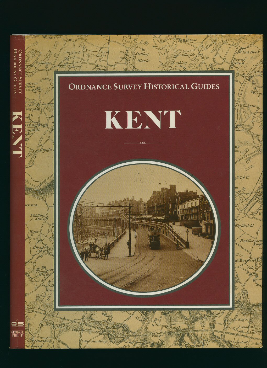
Ordnance Survey Historical Guides: Kent
Hull, Dr. Felix(Book #ID 25418)
Published by George Philip & Son Ltd., London and Ordnance Survey, Southampton First Edition 1988.
First edition hard back binding in publisher's original grey cloth covers, silver lettering to spine. 8vo 10'' x 8'' 136 pp ISBN 0540011347. Colour and monochrome illustrations, 47 maps. Fine condition book in near Fine condition dust wrapper with 25 mm closed tear to top of upper fore edge, not price clipped. Dust wrapper supplied in archival acetate film protection. Member of the P.B.F.A.
Click here to select books from the
KENT [Maps] Category
£25.00
British Landscapes Through Maps: East Kent A Description of the Ordnance Survey Seventh Edition One-inch Sheet 173 [2]
Coleman, Alice M. and Clare T. Lukehurst(Book #ID 56436)
Published by The Geographical Association 1967. 1967.
First edition in publisher's original stapled ivory card covers, black lettering to upper panel. 4to 10'' x 7½'' 30 printed pages of text, Sheet 173 one-inch colour map enclosed. Monochrome photographic illustrations on glossy silk art paper. In Fine condition. Member of the P.B.F.A.
Click here to select books from the
KENT [Maps] Category
£11.00
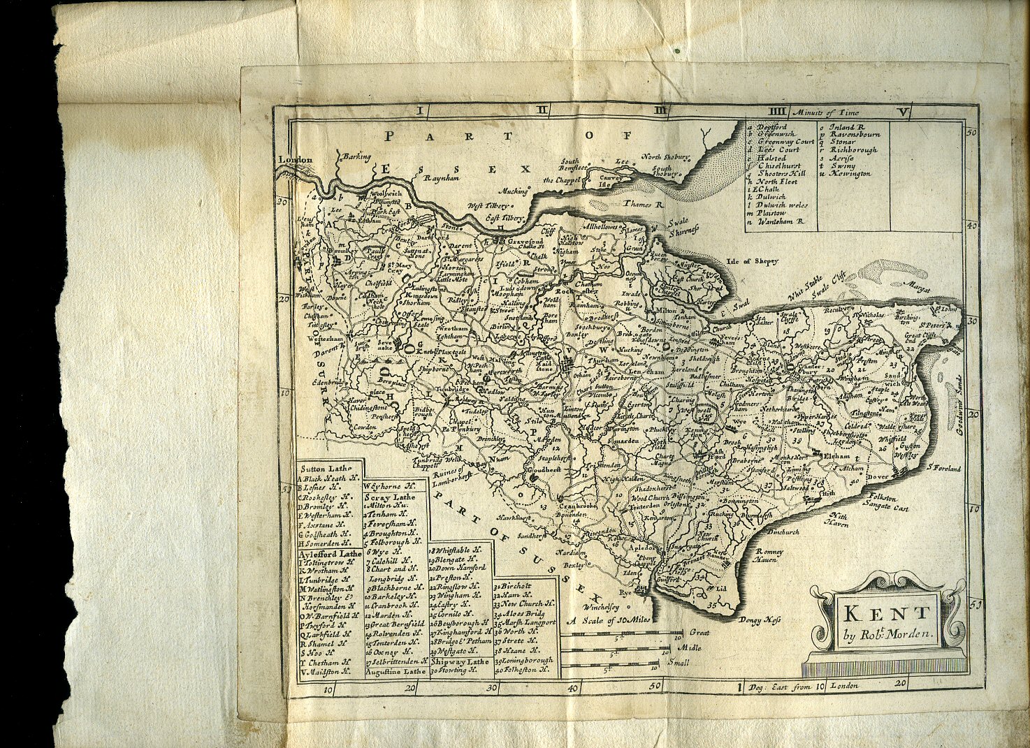
Kent Map
Morden, Robert [Robert Morden (c. 1650 - 1703) was an English bookseller, publisher, and maker of maps and globes. He was among the first successful commercial map makers].(Book #ID 93248)
London 1708. 1708.
Uncoloured copper engraved map 8½'' x 7¼'' inches. Commonly referred to as 'Miniature Morden's' this map was printed as part of 'Fifty Six New and Accurate Maps of Great Britain' published in conjunction with Herman Moll in 1708. Mounted on contemporary paper with a brown stain to the verso of the right hand margin of the mounting paper, (not the map), folded lines across the top and bottom margins of the map, records society label to the reverse of the map. Member of the P.B.F.A.
Click here to select books from the
KENT [Maps] Category
£65.00
Administrative County of Kent Town and Country Planning Act 1971 Development Plan [1967 Revision] Medway Towns Town Map 1970 Revision Comprising the City of Rochester, The Boroughs of Chatham and Gillingham, and Parts of the Rural Districts of Hollingbourn, Malling, Strood and Swale Sheet TQ 86 NW
Deakin, W. H. [Chartered Town Planner County Planning Officer](Book #ID 49084)
Published by Crown Copyright 1971.
Rolled paper map opening to 26½'' x 21½'' drawn with red and green detail, scale six inches to one mile. The complete Town Map comprises 9 sheets. This is sheet TQ 86 NW, we have two of the other eight sheets in stock. Small tears to the edges. Member of the P.B.F.A.
Click here to select books from the
KENT [Maps] Category
£15.00
Administrative County of Kent Town and Country Planning Act 1971 Development Plan [1967 Revision] Medway Towns Town Map 1970 Revision Comprising the City of Rochester, The Boroughs of Chatham and Gillingham, and Parts of the Rural Districts of Hollingbourn, Malling, Strood and Swale Sheet TQ 76 SE
Deakin, W. H. [Chartered Town Planner County Planning Officer](Book #ID 49083)
Published by Crown Copyright 1971.
Rolled paper map opening to 26½'' x 21½'' drawn with red and green detail, scale six inches to one mile. The complete Town Map comprises 9 sheets. This is sheet TQ 76 SE, we have two of the other eight sheets in stock. Small tears to the edges. Member of the P.B.F.A.
Click here to select books from the
KENT [Maps] Category
£15.00
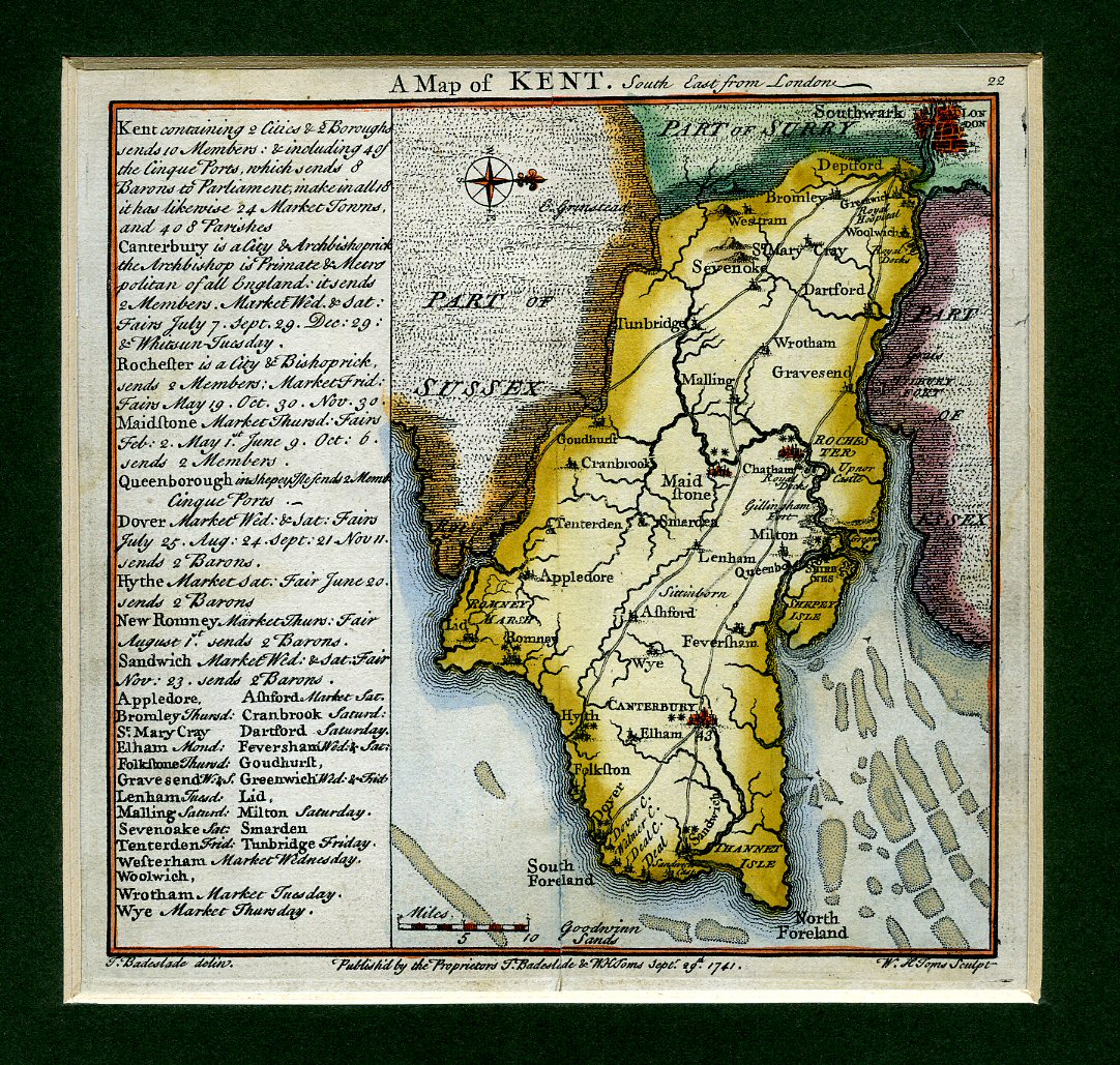
A Hand-Coloured Map of Kent; South East From London 1741
[T. Badeslade & W. H. Toms](Book #ID 47171)
Published by T. Badeslade and W. H. Toms September 29th 1741. 1741.
Mounted hand-coloured map measuring 6'' x 6''. Text to the side gives details of 2 cites, 2 boroughs, sends 10 members; including 4 of the Cinque Ports, which sends 8 Barons to Parliament, make in all 18. It has likewise 24 Market Towns, and 408 Parishes. It lists the Cities, Market Towns with days of the Market. Surrey spelt 'Surry.' Extremely scarce and in near Fine condition. Member of the P.B.F.A.
Click here to select books from the
KENT [Maps] Category
£225.00
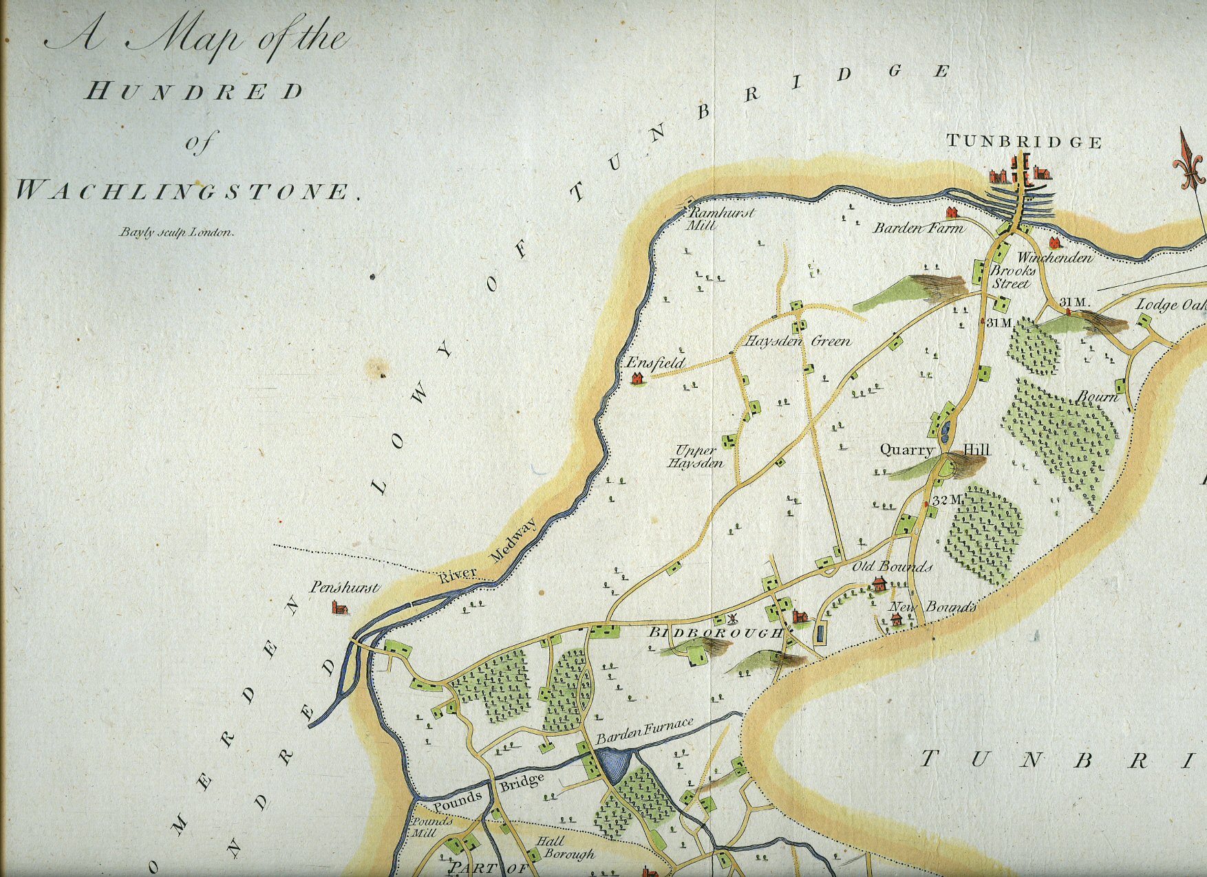
A Hand-Coloured Map of the Hundred of Wachlingstone
The hundred of Wachlingstone encompasses the lowy of Tunbridge on the east, west, and south sides of it. It is written in the survey of Domesday, Warchelestan.(Book #ID 47172)
Bayly Sculp. London circa 1770. London circa 1770.
Hand-coloured map measuring 21'' x 16½''. Somerden Hundred to the West, Brenchley and Horsemonden Hundred to the East, Tunbridge to the North, Tunbridge Wells to the South. Without any tears and in clean fresh condition. Member of the P.B.F.A.
Click here to select books from the
KENT [Maps] Category
£385.00
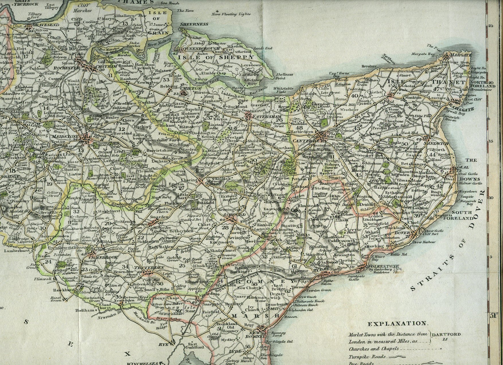
A Hand-Coloured Map of Kent 1829
(Book #ID 47174)
Published by G. Virtue, 26 Ivy Lane, London 1829. London 1829.
Hand-coloured map of Kent measuring 17'' x 14''. Scale 3'' to 12 miles. One small professionally repaired tear to the bottom left corner and in Very Good clean and fresh condition. Member of the P.B.F.A.
Click here to select books from the
KENT [Maps] Category
£225.00
A Coloured Map of Kent 1884 [2]
(Book #ID 47176)
Published by Letts, Son & Co. London Bridge 1884. London 1884.
Coloured map of Kent measuring 17'' x 14''. Inset statistics, Explanation of Signs. Two small repaired tears to the reverse centre fold, in Very Good clean and bright condition. Member of the P.B.F.A.
Click here to select books from the
KENT [Maps] Category
£65.00
A Hand-Coloured Map of Kent circa 1840
[Drawn by R. Creighton] Engraved by J. & C. Walker(Book #ID 47177)
Lewis' Topographical Dictionary, London circa 1840. London circa 1840.
Mounted hand-coloured map of Kent measuring 10'' x 8''. Drawn and engraved for Lewis' Topographical Dictionary and in Fine bright fresh condition. Member of the P.B.F.A.
Click here to select books from the
KENT [Maps] Category
£85.00
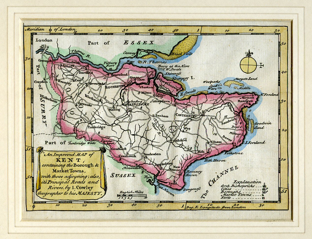
A Hand-Coloured Map of Kent 1744; An Improved Map of Kent Containing the Borough and Market Towns, with those Adjoining; also, its Principal Roads and Rivers by I. Cowley, Geographer to His Majesty
I. Cowley [Geographer to His Majesty](Book #ID 47178)
I. Cowley 1744. London 1744.
Mounted hand-coloured map of Kent measuring 8'' x 6'' in 12 inch by 10 inch mount. In very near Fine condition. Member of the P.B.F.A.
Click here to select books from the
KENT [Maps] Category
£295.00
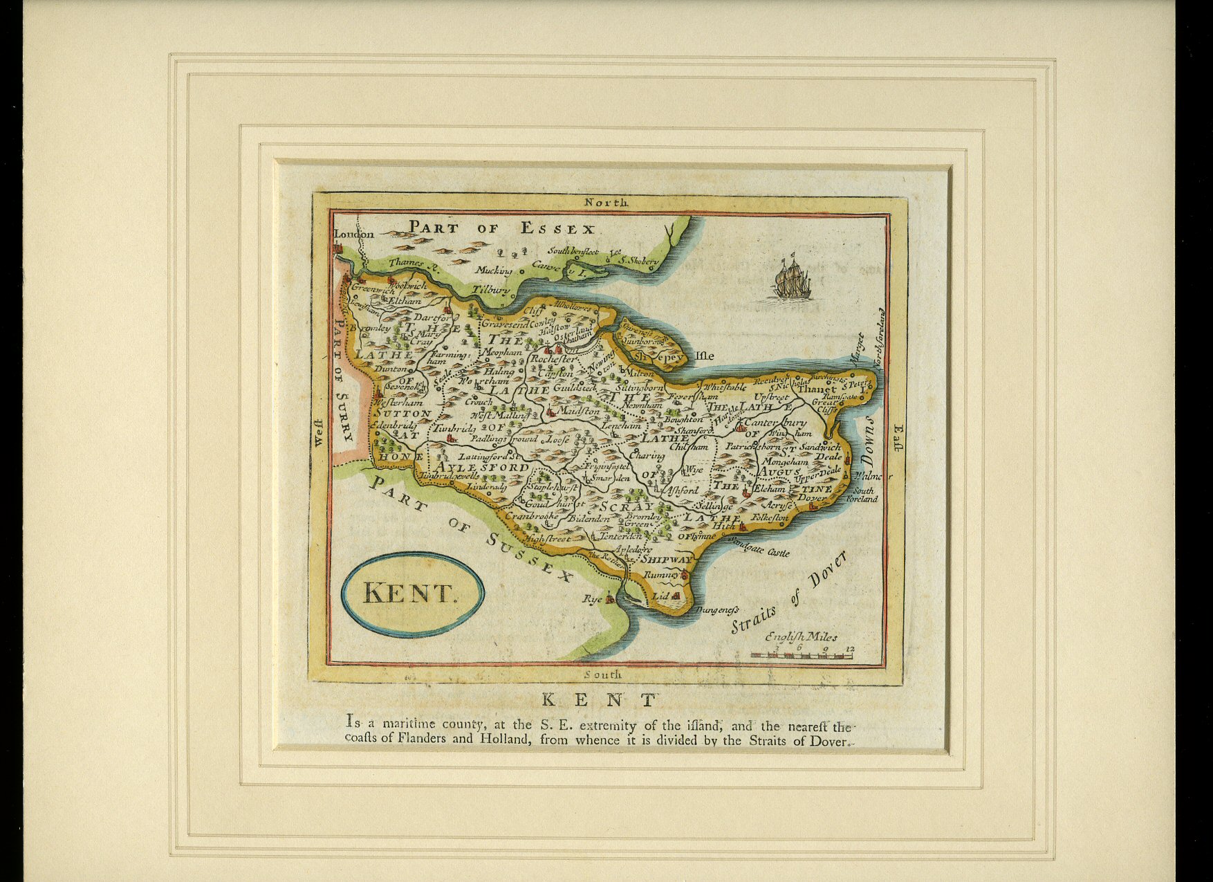
A Hand-Coloured Map of Kent 1770
(Book #ID 47179)
Seller 1770. London 1770.
Mounted hand-coloured map of Kent measuring 5'' x 6'' in 11 inch by 10 inch mount. In Very Good clean condition. Part text below and to the reverse of the map. Member of the P.B.F.A.
Click here to select books from the
KENT [Maps] Category
£195.00
A Hand-Coloured Map of The Isle of Thanet [1]
Thomas Moule [1784-1851](Book #ID 47180)
circa 1840. London circa 1840.
Hand-coloured map of the Isle of Thanet measuring 10'' x 8''. Two inset colour engravings; Ramsgate Harbour, and North Forland Light House, two coats-of-arms in colour, Railway Stations from Ramsgate to Minster. In Very Good clean and bright condition with a slightly ragged top edge. Member of the P.B.F.A.
Click here to select books from the
KENT [Maps] Category
£125.00
A Hand-Coloured Map of The Isle of Thanet [2]
Thomas Moule [1784-1851](Book #ID 47181)
circa 1840. London circa 1840.
Hand-coloured map of the Isle of Thanet measuring 10'' x 8''. Two inset colour engravings; Ramsgate Harbour, and North Forland Light House, two coats-of-arms in colour, Railway Stations from Ramsgate to Minster. In Very Good clean and bright condition with a slightly ragged top edge. Member of the P.B.F.A.
Click here to select books from the
KENT [Maps] Category
£125.00
A Hand-Coloured Map of Kent [1]
[Drawn and Engraved by J. Archer](Book #ID 47182)
J. Archer, Pentonville, London 1848. London 1848.
Hand-coloured map of Kent measuring 10'' x 8''. In Very Good clean and bright condition. Member of the P.B.F.A.
Click here to select books from the
KENT [Maps] Category
£75.00
A Hand-Coloured Map of Kent [2]
[Drawn and Engraved by J. Archer](Book #ID 47183)
J. Archer, Pentonville, London 1848. London 1848.
Hand-coloured map of Kent measuring 10'' x 8''. In Very Good clean and bright condition. Member of the P.B.F.A.
Click here to select books from the
KENT [Maps] Category
£75.00
A Hand-Coloured Map of Kent
[Drawn and Engraved for Dugdales England and Wales](Book #ID 47184)
circa 1845. London circa 1845.
Delineated hand-coloured map of Kent measuring 10'' x 8''. In Very Good clean and bright condition. Member of the P.B.F.A.
Click here to select books from the
KENT [Maps] Category
£75.00
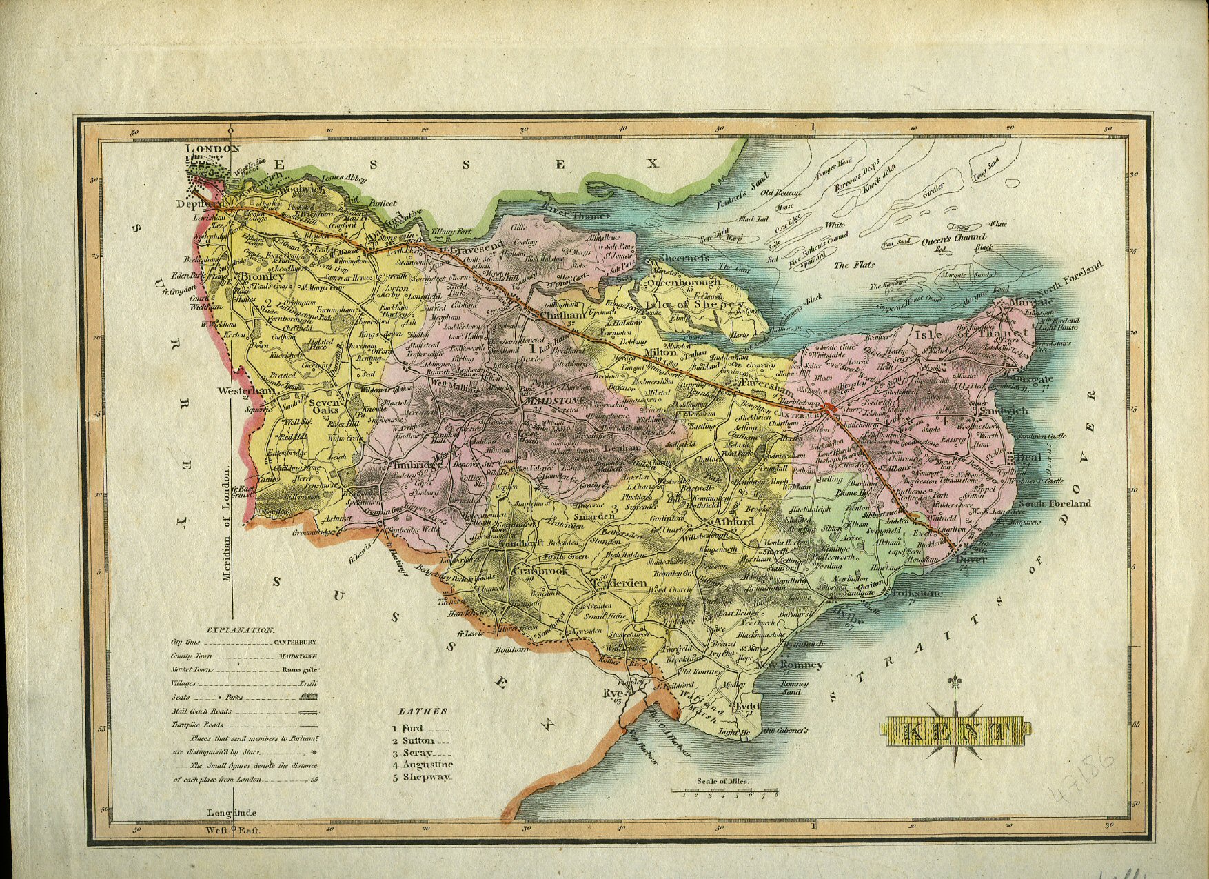
A Hand-Coloured Map of Kent [1]
Neele, Samuel J. [Engraved by](Book #ID 47185)
Published by J. & J. Cunder, Albion, London 1815. London 1815.
Hand-coloured map of Kent measuring 10'' x 8''. In Very Good clean and bright condition. Member of the P.B.F.A.
Click here to select books from the
KENT [Maps] Category
£75.00
A Coloured Map of Kent circa 1820
[Wallis](Book #ID 47186)
circa 1820. 1820.
Coloured map of Kent measuring 11'' x 9''. Legend states Mail Coach Roads, Turnpike Roads. In Very Good clean condition. Member of the P.B.F.A.
Click here to select books from the
KENT [Maps] Category
£50.00
A Coloured Map of Kent circa 1844
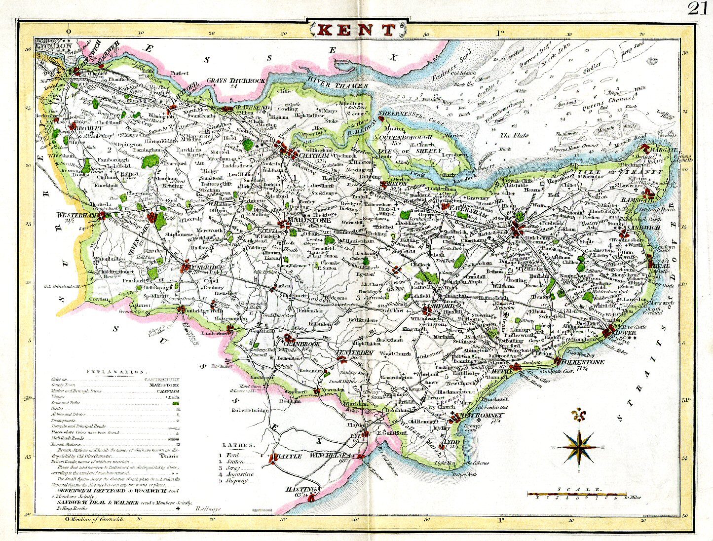
[Drawn and Engraved by J. Archer](Book #ID 47187)
J. Archer, Pentonville, London circa 1844. London circa 1844.
Coloured map of Kent measuring 9'' x 11''. Shows Railroad, Turnpike Roads, Stations, Polling Places. In Very Good clean condition. Member of the P.B.F.A.
Click here to select books from the
KENT [Maps] Category
£50.00
A Coloured Map of Estuary of the Thames and the River Medway
[J. Bartholomew](Book #ID 47188)
J. Bartholomew, Edinburgh circa 1890. 1890.
Coloured map of the Thames Estuary and the River Medway measuring 6½'' x 10''. In Very Good clean condition. Member of the P.B.F.A.
Click here to select books from the
KENT [Maps] Category
£25.00
A Monochrome Map of Kent [Guide to Knowledge]
[Drawn and Engraved by J. Archer](Book #ID 47189)
J. Archer, 100 Drummond Street, Euston Square, London 1833. London 1833.
Monochrome map of Kent measuring 7'' x 10''. From Guide to Knowledge No. LX. Price One Penny. In Very Good clean condition. Member of the P.B.F.A.
Click here to select books from the
KENT [Maps] Category
£20.00
A Hand-Coloured Map of Maidstone, Kent From the Ordnance Survey with Municipal Corporation Boundaries
(Book #ID 47190)
Ordnance Survey 1835. 1835.
Hand-coloured map of Maidstone measuring 13½'' x 8½'' 4 inches to a mile, with small inset map 1 inch to a mile. Also enclosed is a 4 page document titled 'Maidstone, Report upon the Proposed Municipal Boundary and Division into Wards of the Borough of Maidstone.' Two brown stains to the front page of the document. Member of the P.B.F.A.
Click here to select books from the
KENT [Maps] Category
£125.00
A Hand-Coloured Map of Rochester, Kent From the Ordnance Survey with Municipal Corporation Boundaries
(Book #ID 47191)
Ordnance Survey 1835. 1835.
Hand-coloured map of Rochester measuring 13½'' x 10'' 4 inches to a mile, with small inset map 1 inch to a mile. Also enclosed is a 4 page document titled 'Rochester, Report upon the Proposed Municipal Boundary and Division into Wards of the Borough of Rochester.' In Very Good condition. Member of the P.B.F.A.
Click here to select books from the
KENT [Maps] Category
£125.00
Administrative County of Kent Town and Country Planning Act 1971 Development Plan [1967 Revision] Medway Towns Town Map 1970 Revision Comprising the City of Rochester, The Boroughs of Chatham and Gillingham, and Parts of the Rural Districts of Hollingbourn, Malling, Strood and Swale Sheet TQ 86 SW
Deakin, W. H. [Chartered Town Planner County Planning Officer](Book #ID 49082)
Published by Crown Copyright 1971.
Rolled paper map opening to 26½'' x 21½'' drawn with red and green detail, scale six inches to one mile. The complete Town Map comprises 9 sheets. This is sheet TQ 86 SW, we have two of the other eight sheets in stock. Small tears to the edges. Member of the P.B.F.A.
Click here to select books from the
KENT [Maps] Category
£15.00
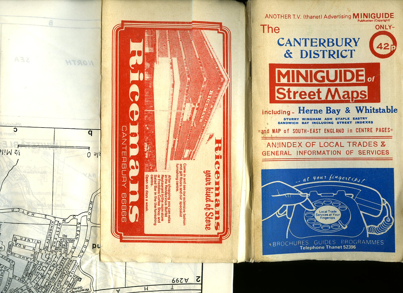
The Canterbury and District Miniguide of Street Maps Including Herne Bay and Whitstable, Sturry, Wingham, Ash, Staple, Eastry, Sandwich Bay
(Book #ID 83493)
Published by T. V. Thanet Advertising, 6 Avebury Avenue, Ramsgate circa 1972.
Original stapled card covered booklet 8'' x 4½'' containing 42 pages plus index with three double-sided sheets [6 maps] to the rear opening to 20'' x 15''. In Very Good condition, priced 42p. Member of the P.B.F.A.
Click here to select books from the
KENT [Maps] Category
£11.00
Records 1 to 27 of 27
Try Another Search
Browse our
Book Categories
AEROPLANES (297)
AFGHANISTAN (16)
AFRICA [Ethiopia] (21)
AFRICA [Ghana] (14)
AFRICA [Kenya] (19)
AFRICA [Malawi] (2)
AFRICA [Mali] (6)
AFRICA [Mozambique] (4)
AFRICA [Nigeria] (13)
AFRICA [Tanzania] (12)
AFRICA [Uganda] (14)
AFRICA [Zambia] (9)
AFRICAN CONTINENT (79)
AGRICULTURE & FARMING (171)
ALBANIA (3)
AMERICA [Civil War] (39)
AMERICA [History] (293)
AMERICA [Indian History] (81)
AMERICA [Literature] (184)
AMERICA [World War II] (25)
ANDERSEN, Hans Christian (17)
ANGLING & SPORT FISHING (157)
ANIMAL SCIENCES (22)
ANNUALS & YEARBOOKS (169)
AQUARIUM & TROPICAL FISH (10)
ARBORICULTURE (37)
ARCHAEOLOGY (408)
ARCHAEOLOGY (Industrial) (33)
ARCHAEOLOGY (Roman Britain) (93)
ARCHAEOLOGY (Scotland) (156)
ARCHITECTURE (394)
ARDIZZONE, Edward (1900-1979) (102)
ARGENTINA (9)
ARMENIA (5)
ART & CRAFT [Japanese] (48)
ART [American] (71)
ART [Applied] (32)
ART [Australian] (14)
ART [Austrian] (8)
ART [British] (346)
ART [Chinese] (37)
ART [Flemish and Dutch] (77)
ART [French] (136)
ART [German] (61)
ART [Indian] (11)
ART [Italian] (71)
ART [Nouveau and Deco] (28)
ART [Russian] (20)
ART [Spanish] (38)
ART [Surrealism] (41)
ART [Technique & Materials] (142)
ARTILLERY, ARMS & ARMOUR (33)
ASIAN CONTINENT (48)
ASTÉRIX French Comic Series (19)
ASTRONAUTICS (17)
ASTRONOMY & COSMOLOGY (70)
AUSTEN, Jane (1775-1817) (27)
AUSTRALIA (Terra Australis) (88)
AUSTRIA (25)
AVIATION & AERONAUTICS (225)
AZERBAIJAN (5)
BALKANS (15)
BALLET & BALLERINAS (37)
BATES, H. E. (1906-1974) (190)
BATTLE OF BRITAIN (84)
BEDFORDSHIRE (17)
BEEKEEPING & APIARISTS (42)
BELGIUM (Gallia Belgica) (26)
BERKSHIRE (Bearroc) (29)
BICYCLES & CYCLING (11)
BIO (Résumé, Memoir) (1003)
BIOLOGY (65)
BLACKSMITHING (9)
BLYTON, Enid (1897-1968) (98)
BOLIVIA (3)
BOOKMARKS (207)
BOOKS (Binding, Collecting, Printing, Paper) (172)
BORNEO | SUMATRA | JAVA (7)
BOTANY (Phytology) (145)
BOY SCOUTS & GIRL GUIDES (44)
BOY'S OWN PAPER (166)
BRAZIL (Brasil) (17)
BRENT-DYER, Elinor M. (13)
BRIDGE, CHESS & GAMES (87)
BRIDGES & TUNNELS (32)
BRITAIN IN PICTURES (165)
BRITISH IMPERIAL EMPIRE (42)
BRITISH PREHISTORY (76)
BROADSHEETS (240)
BRONTË SISTERS (19)
BUCKINGHAMSHIRE (28)
BUDDHISM, HINDU, DHARMA (33)
BUILDING CONSTRUCTION (65)
BULLFIGHTING (Toreo) (11)
BURMA, BURMESE (Myanmar) (101)
BUSES & COACHES (142)
BUSINESS (Leadership) (82)
CAGE & AVIARY BIRDS (55)
CAMBRIDGESHIRE (33)
CAMPAIGN MEDALS (20)
CAMPANOLOGY (1)
CANADA (History & Culture) (112)
CANAL BARGES & WATERWAYS (55)
CANARY ISLANDS (7)
CARAVANS & DORMOBILES (14)
CARPENTRY & D.I.Y. (59)
CARPETS & ORIENTAL RUGS (17)
CARROLL, Lewis (1832-1898) (12)
CARTOGRAPHY, MAPS, PLANS (141)
CATS [Pedigree Domestic Pets] (113)
CENTRAL AMERICA (35)
CERAMICS & POTTERY (245)
CHANNEL ISLANDS (25)
CHEMISTRY (46)
CHESHIRE (Palatine of Chester) (25)
CHILDREN'S & JUVENILE (2105)
CHILE (14)
CHINA & CHINESE HISTORY (111)
CHIVALRY & KNIGHTHOOD (19)
CHRISTIE, Agatha (1890-1976) (18)
CHURCHILL, Winston L. S. (79)
CIGARETTE & TEA CARDS (63)
CINEMA [Front of House Press Photograph] (101)
CINEMA, SCREEN & FILMS (252)
CIRCUS & FAIRGROUNDS (27)
CLIMATOLOGY & WEATHER (18)
COLOMBIA (12)
COMMERCIAL VEHICLES (41)
COMMUNISM (25)
CONCORDE (British Airways) (26)
COOK, Captain James (5)
CORNWALL (Kernow) (97)
COUNTY DURHAM (31)
CRETE (Kriti | Krete) (10)
CRIMEA and GEORGIA (25)
CROSBY, Bing (1903-1977) (194)
CUBA (Republic of Cuba) (12)
CYPRUS (Republic of Cyprus) (8)
CZECHOSLOVAKIA (60)
DANCING & CHOREOGRAPHY (28)
DECORATIVE ARTS (207)
DEFOE, Daniel (c. 1660-1731) (19)
DEMOGRAPHY (Populations) (38)
DENMARK (Danish Danmark) (18)
DENMARK (Danish | Danmark) (8)
DERBYSHIRE (Peak District) (20)
DETECTIVE | CRIME FICTION (793)
DEVONSHIRE (Dumnonia) (146)
DICKENS, Charles (1812-1870) (52)
DITCHFIELD SERIES (412)
DIVING & SNORKELLING (10)
DOGS (Pedigree Pets) (88)
DOLLS’ HOUSES & DOLLS (43)
DORSET (Durnovaria) (67)
DOYLE, [Sir] Arthur Conan (19)
DRAWING & CRAFTSMANSHIP (103)
ECOLOGY (Earth Science) (47)
ECONOMICS & COMMERCE (274)
ECUADOR (Ecuadorian) (5)
EDUCATION (Teaching) (99)
ELECTRICAL ENGINEERING (62)
ENGINEER (Invent, Innovate) (108)
ENGLAND EXPLORATION (84)
ENGLISH HISTORY (384)
ENGLISH LANGUAGE (107)
ENGLISH LITERATURE (261)
ENTOMOLOGY (92)
ENVIRONMENTAL (54)
EQUINE & EQUESTRIANISM (102)
ESPIONAGE (Clandestine) (92)
ESSEX (Eastseaxe) (70)
ESTONIA, LATVIA & LITHUANIA (9)
ETCHINGS (10)
ETON (Old Etonians) (19)
EUROPE & EUROPEANS (55)
FALKLAND ISLANDS (31)
FASHION (Costume & Millinery) (124)
FEMINISM & FEMINISTS (79)
FINLAND (Suomi, Finnish) (19)
FIREARMS (Defence Weapons) (44)
FIREMEN & FIRE SERVICE (36)
FIRST WORLD (Great) WAR (203)
FLEMING, Ian (1908-1964) (29)
FOLIO SOCIETY (158)
FOOD [Asian & Ethnic] (17)
FOOD [British Cookery] (116)
FOOD [Cuisine Française] (40)
FOOD [Desserts & Pâtisserie] (58)
FOOD [Dietary] (21)
FOOD [Hotels & Restaurants] (48)
FOOD [Retail Brands] (52)
FRANCE [Literature & History) (473)
GAMBLING & BETTING (16)
GARDEN & HORTICULTURE (154)
GENETICS (10)
GEOGRAPHY (Human, Physical) (38)
GERMANY [Language, History] (200)
GERMANY [Luftwaffe & Pilots] (47)
GERMANY [World War II] (79)
GIBRALTAR (13)
GILBERT W. S. & A. SULLIVAN (55)
GLASS (Blowing, Stained) (97)
GLOUCESTERSHIRE (63)
GOVERNMENT & POLITICS (194)
GRAPHIC DESIGN (Visual Arts) (60)
GREECE (Ancient Greek) (134)
GUYANA [Guiana] (2)
GYPSY & ROMANY (7)
HAMPSHIRE (Hantescire) (64)
HANDICRAFTS (Artisanship) (74)
HEBRIDES & ST. KILDA (21)
HENTY, G. A. (1832-1902) (51)
HERALDRY (Armorial Bearings) (51)
HEREFORDSHIRE (14)
HERTFORDSHIRE (43)
HITLER, Adolf (1889-1945) (38)
HONG KONG (18)
HOROLOGY & CHRONOMETRY (42)
HUMOUR (Satire, Cartoon) (401)
HUNGARY (Magyarország) (52)
HUNTS & GAME SHOOTING (101)
I-SPY SERIES (5)
ICELAND (Ísland, Icelandic) (32)
ICHTHYOLOGY (Fish Science) (63)
ILLUSTRATED (Picture Book) (254)
INDIA (Bharat Ganarajya) (200)
INNES, Hammond (1913-1998) (30)
INTERIOR DESIGN (105)
IRAN [Persia] (31)
IRAQ (28)
IRELAND (Éire) (122)
ISLAM (Islamic Art) (41)
ISLE OF LUNDY (7)
ISLE OF MAN (26)
ISLE OF SHEPPEY (9)
ISLE OF SKYE (7)
ISLE OF THANET (34)
ISLE OF WIGHT (45)
ISLES OF SCILLY (9)
ISRAEL (56)
ITALY (History & Culture) (257)
JAPAN (History & Culture) (324)
JAPAN (World War II) (25)
JERUSALEM (25)
JOHNS, Captain W. E. (87)
JORDAN (7)
KAZAKHSTAN (6)
KENT [Airfields and at War] (44)
KENT [Antiquarian] (25)
KENT [Archaeologia Cantiana] (37)
KENT [Ashford] (29)
KENT [Ash] (6)
KENT [Birchington-on-Sea] (8)
KENT [Broadstairs] (5)
KENT [Bromley] (34)
KENT [Bygone Magazine] (30)
KENT [Canterbury] (121)
KENT [Chatham] (20)
KENT [Cinque Ports] (16)
KENT [Deal] (68)
KENT [Dover] (53)
KENT [Eastry] (6)
KENT [Elham] (9)
KENT [Faversham] (28)
KENT [Folkestone] (34)
KENT [Fordwich & Sturry] (10)
KENT [Gravesend & Dartford] (13)
KENT [Herne Bay] (26)
KENT [Hops] (15)
KENT [Ickham, Wickhambreaux] (6)
KENT [Maidstone] (34)
KENT [Maps] (27)
KENT [Margate] (26)
KENT [Ramsgate] (26)
KENT [Rochester & Strood] (36)
KENT [Romney & Hythe] (42)
KENT [Sandwich] (53)
KENT [Sevenoaks] (24)
KENT [Sittingbourne] (6)
KENT [Stourmouth] (16)
KENT [Tenterden] (10)
KENT [Tonbridge] (10)
KENT [Topography] (158)
KENT [Tunbridge Wells] (47)
KENT [Weald] (16)
KENT [Whitstable] (16)
KENT [Wingham] (14)
KENT [Wye] (6)
KEYBOARD INSTRUMENTS (55)
KING PENGUIN (Series) (64)
KIPLING, Rudyard (1865-1936) (28)
KOREA (History and Culture) (60)
LADYBIRD SERIES (12)
LAKE DISTRICT (60)
LANCASHIRE (64)
LATIN (45)
LAW, JUSTICE, LEGAL SYSTEM (80)
LEBANON (5)
LEICESTERSHIRE (21)
LIGHTHOUSES (13)
LINCOLNSHIRE (105)
LINGUISTICS (14)
LITERARY CRITICISM (101)
LITERATURE 1900-1925 (373)
LITERATURE 1926-1945 (500)
LITERATURE 1926-1945 (1)
LITERATURE BEFORE 1800 (16)
LIVERPOOL (29)
LONDON (Londinium) (480)
LONDON (Postcards) (56)
MADAGASCAR (Madagasikara) (4)
MAGIC & CONJURING (949)
MALAYSIA (History & Culture) (43)
MALTA (Maltese History) (24)
MAURITIUS (Mascarenhas) (18)
MAYERL, Billy (1902-1959) (138)
McGILL, Donald (1875-1962) (24)
MECCANO MAGAZINE (88)
MEDICINE & HEALTH (193)
METALLURGY (45)
MEXICO (44)
MICROBIOLOGICAL (23)
MIDDLESEX (Middleseaxan) (19)
MILITARY (Armed Warfare) (171)
MILLIGAN, Spike (1918-2002) (162)
MINING & GEOLOGY (108)
MINING INDUSTRY CORNWALL (12)
MINING INDUSTRY WALES (24)
MISSIONARY (Proselytism) (69)
MODERN FIRST EDITIONS (2863)
MONARCHY (139)
MONGOLIA (23)
MONTHLY TRACT SOCIETY (80)
MOTOR BIKES (79)
MOTORING, SPORTS CARS (458)
MOUNTAINEERING (83)
MUSIC [Classical] (501)
MUSIC [Jazz] (45)
MUSIC [Rock & Pop] (79)
MYSTICISM (UFO's, Folklore) (44)
MYTHOLOGY & LEGENDS (71)
NAPOLÉON Bonaparte (45)
NATURAL HISTORY (132)
NAUTICAL (Shipbuilding) (105)
NEEDLEWORK & TEXTILES (280)
NELSON, Horatio (1758-1805) (23)
NETHERLANDS (Holland) (60)
NEW NATURALIST (Series) (138)
NEW ZEALAND (Aotearoa) (35)
NEWSPAPERS (85)
NINETEENTH CENTURY (473)
NORFOLK (Norfolcia) (80)
NORTH AFRICA [Algeria] (6)
NORTH AFRICA [Egypt] (174)
NORTH AFRICA [Libya] (14)
NORTH AFRICA [Morocco] (25)
NORTH AFRICA [Sahara] (13)
NORTH AFRICA [Sudan] (177)
NORTH AFRICA [Tunisia] (6)
NORTHAMPTONSHIRE (11)
NORTHUMBERLAND (54)
NORWAY & NORWEGIAN (58)
NOTTINGHAMSHIRE (14)
NUMISMATICS (Currency) (23)
NUTRITION (Nutrients) (107)
OBSERVER’S (Series) (373)
OCCULT (Spirituality) (23)
OIL & PETROL INDUSTRY (46)
OMAN (3)
OPERA (56)
OPPENHEIM, E. P. (1866-1946) (78)
ORKNEY & SHETLAND (8)
ORNITHOLOGY (181)
OXENHAM, Elsie Jeanette (13)
OXFORDSHIRE (Oxonium) (34)
PACIFIC (Oceania) (34)
PAKISTAN (15)
PALAEONTOLOGY (23)
PALESTINE (19)
PAPERBACKS (261)
PAPUA NEW GUINEA (11)
PERU (24)
PHILATELY (Postal History) (33)
PHILOSOPHY (200)
PHOTOGRAPHS (61)
PHOTOGRAPHY (132)
PHYSICS (60)
PICTURE COMICS (2039)
PIERS, PAVILIONS & SEASIDE (25)
PIPE, CIGAR & MATCHES (17)
PLAYS (Theatre Performance) (227)
POETRY, VERSE & RHYMES (840)
POLAND & POLISH HISTORY (52)
POLAR [Antarctic] (36)
POLAR [Arctic] (30)
POLICE & PRISONS (42)
POP-UP MOVABLE BOOKS (42)
PORTUGAL & PORTUGUESE (17)
POSTCARDS (225)
POTTER, Beatrix (1866-1943) (26)
PRINTS (39)
PROOF COPY (Advance) (84)
PSYCHIATRY (14)
PSYCHOLOGY (Behaviour) (148)
RADIO [Wireless Telephony] (84)
RAILWAYS & LOCOMOTIVES (538)
RELIGIOUS PAMPHLETS (156)
RELIGIOUS TRACT SOCIETY (172)
ROBIN HOOD BOOKS (12)
ROMAN EMPIRE (Romanum) (147)
ROMANIA [Roumania] (7)
ROWLING, J. K., (6)
ROYAL AIR FORCE (RAF) (147)
ROYAL NAVY (RN) (402)
Rubáiyát of Omar Khayyám (219)
RURAL VILLAGE LIFE (260)
RUSSIAN & SOVIET HISTORY (147)
RUSSIAN [Language] (51)
RUSSIAN [Literature] (114)
RUSSIAN [Military] (27)
SAILING BOATS (Yachting) (113)
SAS & COMMANDOES (22)
SAUDI ARABIA (Arabian) (48)
SAVILLE, Malcolm (1901-1982) (20)
SCIENCE FICTION (68)
SCIENCE FICTION MAGAZINES (625)
SCOTLAND (Gaelic: Alba) (334)
SCOTLAND YARD (6)
SCRAPBOOK (Victorian Cuttings) (5)
SEXTON BLAKE LIBRARY (183)
SEYCHELLES (1)
SHAKESPEARE, William (105)
SHEET MUSIC (1575)
SHIPPING (Liners, Merchant) (222)
SHORT STORIES (Novella) (216)
SHROPSHIRE (Salop) (12)
SIBERIA (Sibir, Siberian) (7)
SICILY (Regione Siciliana) (18)
SLAVERY & TORTURE (9)
SLOVAKIA (Slovenská republika) (7)
SMUGGLING & HIGHWAYMEN (23)
SOCIAL & HUMANITIES (293)
SOCIALISM (Social Democracy) (19)
SOMERSET (Sumortunsæte) (51)
SOUTH AFRICA (Zuid-Afrika) (120)
SPAIN & SPANISH HISTORY (86)
SPANISH CIVIL WAR (21)
SPECIAL OPERATIONS [S.O.E.] (21)
SPORT [Archery] (14)
SPORT [Athletics] (11)
SPORT [Badminton] (4)
SPORT [Billiards & Snooker] (10)
SPORT [Bodybuilding] (30)
SPORT [Bowls & Bowling] (8)
SPORT [Boxing] (42)
SPORT [Cricket] (410)
SPORT [Croquet] (3)
SPORT [Fencing] (5)
SPORT [Football] (327)
SPORT [Golf] (314)
SPORT [Greyhounds] (68)
SPORT [Hockey & Lacrosse] (6)
SPORT [Horse Racing] (143)
SPORT [Lawn Tennis] (70)
SPORT [Netball] (4)
SPORT [Olympics] (15)
SPORT [Polo] (7)
SPORT [Rugby] (31)
SPORT [Self Defence] (25)
SPORT [Skating] (2)
SPORT [Skiing] (8)
SPORT [Speedway] (16)
SPORT [Squash] (5)
SPORT [Swimming] (8)
SRI LANKA [Ceylon] (8)
STAFFORDSHIRE (14)
STAGE & THEATRE (191)
STEVENSON, Robert Louis (40)
STORIES FOR BOYS (452)
STORIES FOR GIRLS (239)
STRUWWELPETER (12)
SUBMARINES (33)
SUFFOLK (Suffolcia) (40)
SURREY (Suthrige) (102)
SURVIVAL TECHNIQUES (8)
SUSSEX (Suth-Seaxe) (141)
SUSSEX [Bexhill-on-Sea] (11)
SUSSEX [Brighton & Hove] (30)
SUSSEX [Eastbourne] (26)
SUSSEX [Hastings] (61)
SUSSEX [Rye & Winchelsea] (25)
SWEDEN (History & Culture) (43)
SWITZERLAND (Culture) (39)
SYKES, Eric (1923-2012) (23)
SYRIA (History and Culture) (9)
TECHNOLOGY (Industrial Arts) (79)
TELECOMMUNICATIONS (48)
TELEVISION ENGINEERING (48)
TERRORISM (17)
THAILAND [Siam] (17)
The B.B.C. (Broadcasting) (86)
THEATRE (Cinema) POSTERS (124)
THEATRE PROGRAMMES (1226)
THEOLOGY & RELIGION (814)
TIBET (Qing Dynasty) (17)
TITANIC (White Star Line) (23)
TOWN & RURAL PLANNING (37)
TOY & MODEL MAKING (185)
TRACTION STEAM ENGINES (27)
TRAMS & TROLLEYBUSES (94)
TRUE CRIME (130)
TUGS AND TOWING (17)
TURKEY (History and Culture) (25)
UKRAINE (6)
UNIFORMS & BADGES (21)
UTTLEY, Alison (1884-1976) (19)
UZBEKISTAN (5)
VETERINARY MEDICINE (9)
VICTORIA CROSS AWARDS (42)
VIETNAM (History & Culture) (29)
VINYL RECORDS 45 r.p.m. | LPs 33 (37)
WALES & WELSH LITERATURE (201)
WARWICKSHIRE (Wæringscir) (41)
WAYSIDE WOODLAND (Series) (104)
WELLINGTON, Duke of (1769-1852) (51)
WEST INDIES [Caribbean] (27)
WESTERNS [U.S.A Old West] (118)
WHALING & WHALES (18)
WILTSHIRE (Wiltunscir) (30)
WIND & WATERMILLS (31)
WINES, BEERS & SPIRITS (76)
WOODCUTS & ENGRAVINGS (35)
WORCESTERSHIRE (7)
WORLD WAR II (Second) (454)
YORKSHIRE (Jórvík) (188)
YUGOSLAVIA (14)
ZEPPELINS, AIRSHIPS & BALLOONING (37)
ZOOLOGY (Animal Biology) (62)
top of page


![Ordnance Survey One-Inch Map : Sheet 172 Chatham & Maidstone [2]](covers/6767.jpg)
![British Landscapes Through Maps: East Kent A Description of the Ordnance Survey Seventh Edition One-inch Sheet 173 [2]](covers/56436.jpg)
![Administrative County of Kent Town and Country Planning Act 1971 Development Plan [1967 Revision] Medway Towns Town Map 1970 Revision Comprising the City of Rochester, The Boroughs of Chatham and Gillingham, and Parts of the Rural Districts of Hollingbourn, Malling, Strood and Swale Sheet TQ 86 NW](covers/49084.jpg)
![Administrative County of Kent Town and Country Planning Act 1971 Development Plan [1967 Revision] Medway Towns Town Map 1970 Revision Comprising the City of Rochester, The Boroughs of Chatham and Gillingham, and Parts of the Rural Districts of Hollingbourn, Malling, Strood and Swale Sheet TQ 76 SE](covers/49083.jpg)
![A Coloured Map of Kent 1884 [2]](covers/47176.jpg)

![A Hand-Coloured Map of The Isle of Thanet [1]](covers/47180.jpg)
![A Hand-Coloured Map of The Isle of Thanet [2]](covers/47181.jpg)
![A Hand-Coloured Map of Kent [1]](covers/47182.jpg)
![A Hand-Coloured Map of Kent [2]](covers/47183.jpg)
![A Hand-Coloured Map of Kent [1]](covers/47185.jpg)


![A Monochrome Map of Kent [Guide to Knowledge]](covers/47189.jpg)


![Administrative County of Kent Town and Country Planning Act 1971 Development Plan [1967 Revision] Medway Towns Town Map 1970 Revision Comprising the City of Rochester, The Boroughs of Chatham and Gillingham, and Parts of the Rural Districts of Hollingbourn, Malling, Strood and Swale Sheet TQ 86 SW](covers/49082.jpg)
